Stake attention in this memory
historical
geographical
educational
informative
neutral
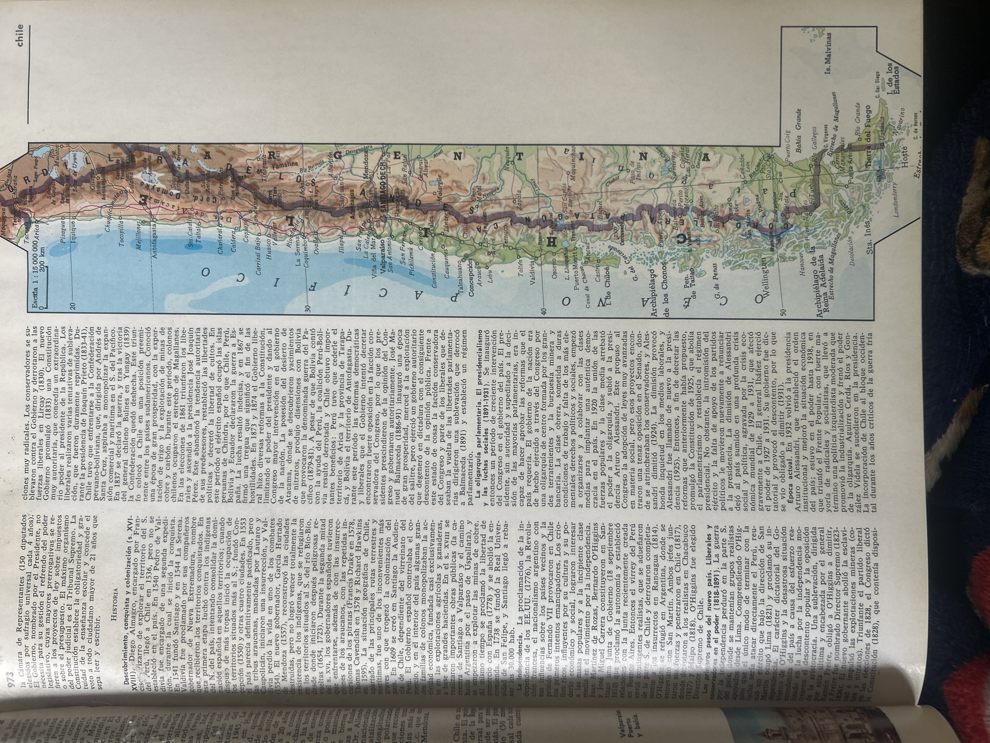
This image is a scanned historical map of Chile, showing its geography, cities, and political divisions. The text is in Spanish. There is no mention of Santa Ana, Venezuela, in the image, nor is there any depiction of people or contemporary events. The map features topographical details such as mountain ranges, rivers, and coastlines. Cities are marked with names and sometimes elevations. Latitude lines are present, indicating geographical orientation. The overall appearance suggests it is from a printed publication, likely an atlas or historical document.
transactions
revenues
stakers
Earliest
Latest
Highest stake
No transactions found