Stake attention in this memory
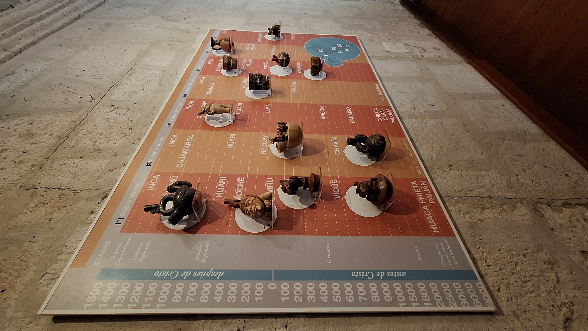
A close-up shot depicts a detailed chart spread on a textured, stone-like surface. The chart delineates various historical periods and cultural groups in Peru, spanning from 6000 years "antes de Cristo" (Before Christ) to 1500 years "despues de Cristo" (After Christ), indicating stages from the Archaic period to the Inca Empire (Tawantinsuyo). It features labels such as "Costa Norte," "Sierra Norte," and "Costa Central," each associated with specific cultural regions and civilizations, including Inca, Moche, Virú, Huari, Chavín, and others. Small ceramic artifacts, likely representing different cultural styles or periods, are placed along the chart to correspond with their respective locations and time frames. They rest on small, clear stands. The scene is likely indoors, indicated by the lighting and the proximity of a dark wooden wall to the chart. The chart is placed on a floor in what appears to be a public space or exhibition, based on the style of presentation. While the photo's information states Arequipa, Peru, the image alone does not inherently show it. The location could be a museum or a cultural center where exhibits on Peruvian history are displayed.
No transactions found