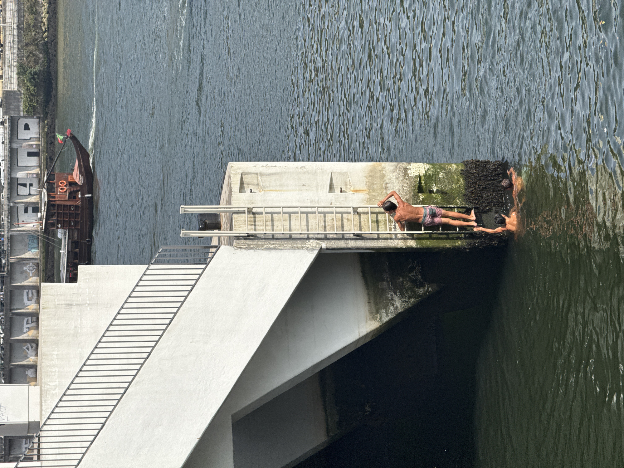
Stake attention in this memory
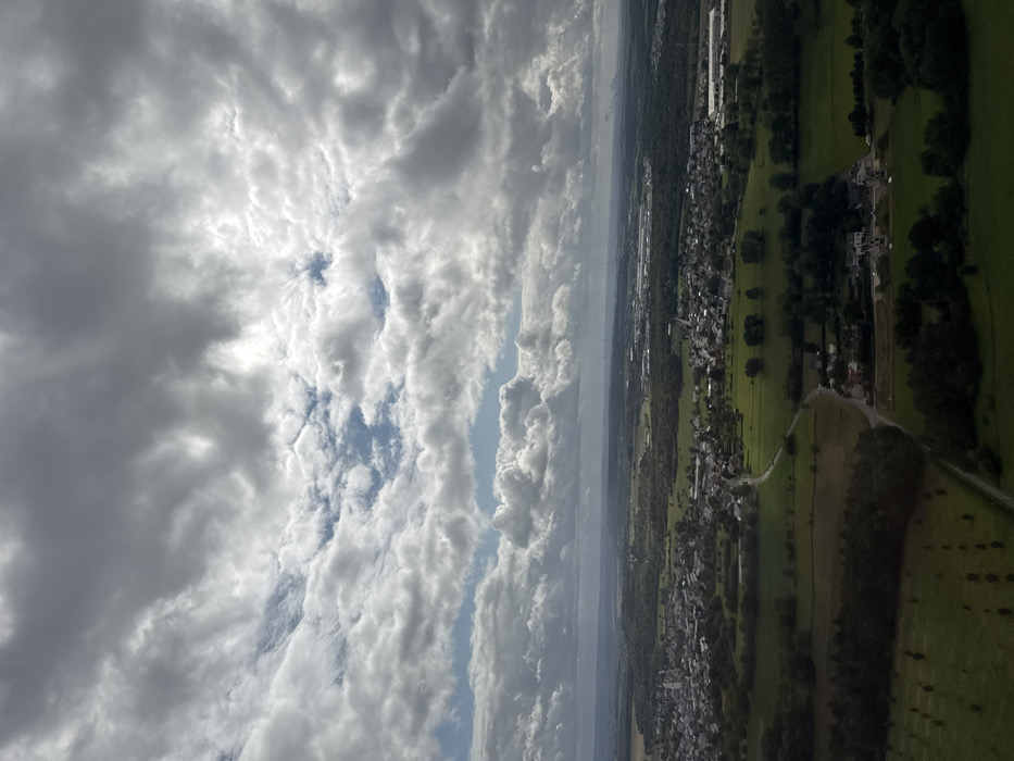
An aerial photograph depicts a panoramic view of the Findel, Luxembourg region, looking west-northwest from an elevated perspective. The sky occupies approximately two-thirds of the frame, dominated by a dense formation of grey and white cumulus clouds, with intermittent patches of blue sky visible through breaks. The lower third of the image showcases an expansive, undulating landscape. In the lower-left quadrant, the town of Niederanven is visible, characterized by a compact cluster of buildings with light-colored roofs and a prominent church spire. Extensive green agricultural fields and dark green forested areas separate and surround the settlements. Winding roads, appearing as thin grey lines, traverse these fields. Towards the mid-right, an extensive complex of large, modern industrial or commercial buildings, consistent with the cargo and logistics facilities of Luxembourg Airport (Findel), occupies a significant portion of the landscape. Scattered residential structures are interspersed within the rural and semi-urban fabric. No human figures, vehicles, or discernible activities are individually identifiable within the frame.
No transactions found