Sign in
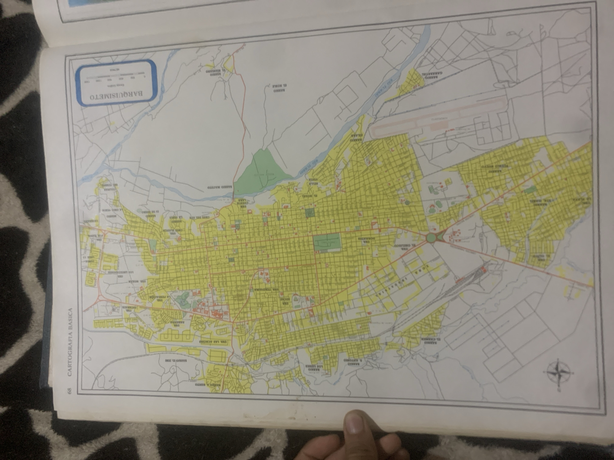
This media file is a photograph of an open map, likely from a book or atlas, displaying a detailed urban area. The map is predominantly colored yellow, indicating residential zones, with white areas representing other land uses like undeveloped land, roads, and bodies of water. Various colored lines denote roads and rivers.

The map includes numerous labels in Spanish, identifying different neighborhoods (barrios) and urban areas (urb.). Some prominent labels visible include "BARQUISIMETO," "BARRIO MANZANO," "BARRIO MACUTO," "EL RORAL," "BELLA VISTA," "RIO TURMA," "BARRIO EL JERE," "URS. LAS ACACIAS," "BARRIO & BENITO," "BARRIO LOS LUISES," "BARRIO ANTONIO," "BARRIO GARABATAL," and "URB. BABAIDA." There is also a section labeled "CARTOGRAFIA BASICA" with the number "68" on the left side of the page. A scale bar indicating "METROS" is present in the upper left corner. An airport with runways and buildings is depicted in the upper right quadrant of the map. A compass rose is visible in the lower right corner.

The photograph is taken from a slightly angled overhead perspective, showing a portion of a dark, patterned surface beneath the map, which appears to be a rug or fabric. A hand is visible in the lower right corner, holding an object that partially obscures the map. The lighting suggests it is indoors, with no specific time of day or weather conditions discernible. The overall impression is of a cartographic document detailing the geographical layout of a Venezuelan city.
bombolico

Jun 25, 2026, 2:26 PM

La Tagua, Venezuela

BLOCKED

Stake attention in this memory

nostalgic
analytical
curious
focused
composed

This media file is a photograph of an open map, likely from a book or atlas, displaying a detailed urban area. The map is predominantly colored yellow, indicating residential zones, with white areas representing other land uses like undeveloped land, roads, and bodies of water. Various colored lines denote roads and rivers. The map includes numerous labels in Spanish, identifying different neighborhoods (barrios) and urban areas (urb.). Some prominent labels visible include "BARQUISIMETO," "BARRIO MANZANO," "BARRIO MACUTO," "EL RORAL," "BELLA VISTA," "RIO TURMA," "BARRIO EL JERE," "URS. LAS ACACIAS," "BARRIO & BENITO," "BARRIO LOS LUISES," "BARRIO ANTONIO," "BARRIO GARABATAL," and "URB. BABAIDA." There is also a section labeled "CARTOGRAFIA BASICA" with the number "68" on the left side of the page. A scale bar indicating "METROS" is present in the upper left corner. An airport with runways and buildings is depicted in the upper right quadrant of the map. A compass rose is visible in the lower right corner. The photograph is taken from a slightly angled overhead perspective, showing a portion of a dark, patterned surface beneath the map, which appears to be a rug or fabric. A hand is visible in the lower right corner, holding an object that partially obscures the map. The lighting suggests it is indoors, with no specific time of day or weather conditions discernible. The overall impression is of a cartographic document detailing the geographical layout of a Venezuelan city.

Symbol

8CE41

Volume

0

Creator

+$0.09

Revenue

+$0.00

TVL

$0.00

1D
1W
1M
All

Loading AttnAds…

transactions
revenues
stakers
Earliest
Latest
Highest stake

1

Katy

Staked 10d ago
Redeemed 4d ago

$7.22 USD

+$0.07 USD

Fee: $0.02 (0.25%)

+1.0%

2

Rev Bot 🤖💰

Injected revenue 10d ago

Revenue bonus for the last stake.

+$0.18 USD

More from this user

More from La Tagua

bombolico

Jun 25, 2026, 2:26 PM

La Tagua, Venezuela

Licensed under Creative Commons Attribution 4.0 International License. You are free to share and adapt this content with proper attribution.





