Stake attention in this memory
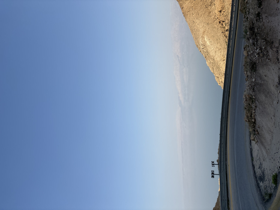
An elevated landscape photograph captures a winding asphalt road, featuring a sharp left-hand curve, in the Megilot Yam HaMelakh Regional Council, Palestinian Territory. The road is dark grey with faint white and yellow markings, bordered by a silver metal guardrail. Two black and white chevron road signs, indicating a sharp left turn, are positioned beyond the guardrail. To the right, a barren, rocky, tan-brown hillside descends. In the middle ground, a large body of light blue water, consistent with the Dead Sea, stretches into the distance, with hazy, light-colored mountains visible on the far horizon. The upper two-thirds of the image depict a clear, bright blue sky. No individuals, vehicles, or specific actions are present in the scene.
Symbol
8E48D
Volume
1,763
Creator
+$0.00
Revenue
+$0.00
TVL
$0.44