Sign in
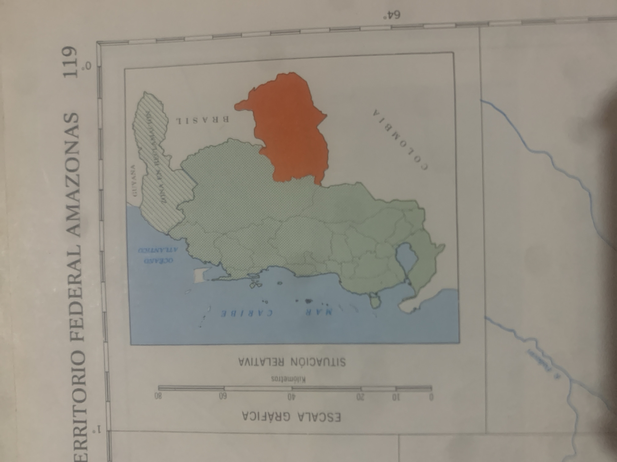
This is a rotated image of a map showing a portion of South America, specifically the territory of Amazonas in Venezuela. The main focus is a highlighted region colored orange, representing a specific area within the larger territory. The map displays borders with neighboring countries: Guyana to the northwest, Brazil to the south and east, and Colombia to the west. The Atlantic Ocean and the Caribbean Sea are also visible to the northeast.

Text on the map includes geographical labels like "TERRITORIO FEDERAL AMAZONAS," "GUYANA," "BRASIL," and "COLOMBIA." It also indicates "OCEANO ATLANTICO" and "MAR CARIBE." A graphic scale is provided in kilometers with markings at 0, 10, 20, 40, 60, and 80. The text "SITUACIÓN RELATIVA" appears above the scale. Latitude and longitude lines are also visible, with a longitude mark at 64 degrees. The number "119" is prominently displayed on the left side of the map. The overall scene is that of a cartographic representation, likely for informational or geographical study, with no people or specific events depicted. The time of day and weather are not discernible from the image.
bombolico

Jun 25, 2026, 2:41 PM

La Tagua, Venezuela

BLOCKED

Stake attention in this memory

informative
analytical
neutral
formal
serious

This is a rotated image of a map showing a portion of South America, specifically the territory of Amazonas in Venezuela. The main focus is a highlighted region colored orange, representing a specific area within the larger territory. The map displays borders with neighboring countries: Guyana to the northwest, Brazil to the south and east, and Colombia to the west. The Atlantic Ocean and the Caribbean Sea are also visible to the northeast. Text on the map includes geographical labels like "TERRITORIO FEDERAL AMAZONAS," "GUYANA," "BRASIL," and "COLOMBIA." It also indicates "OCEANO ATLANTICO" and "MAR CARIBE." A graphic scale is provided in kilometers with markings at 0, 10, 20, 40, 60, and 80. The text "SITUACIÓN RELATIVA" appears above the scale. Latitude and longitude lines are also visible, with a longitude mark at 64 degrees. The number "119" is prominently displayed on the left side of the map. The overall scene is that of a cartographic representation, likely for informational or geographical study, with no people or specific events depicted. The time of day and weather are not discernible from the image.

Symbol

8E5E2

Volume

8,101

Creator

+$0.04

Revenue

+$0.05

TVL

$3.49

1D
1W
1M
All

Loading AttnAds…

transactions
revenues
stakers
Earliest
Latest
Highest stake

1

Ramón

Staked 10d ago

$3.48 USD

+$0.02 USD

+0.5%

2

Rev Bot 🤖💰

Injected revenue 10d ago

Revenue bonus for the last stake.

+$0.06 USD

More from this user

More from La Tagua

bombolico

Jun 25, 2026, 2:41 PM

La Tagua, Venezuela

Licensed under Creative Commons Attribution 4.0 International License. You are free to share and adapt this content with proper attribution.





