Stake attention in this memory
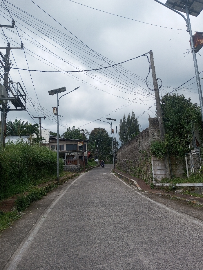
The image depicts an uphill paved road in Zeyathiri District, Myanmar, under an overcast sky. The road, featuring white edge markings, recedes into the distance. On the left side, a dense growth of green bushes borders the road, behind which a two-story building with a dark roof and prominent windows is visible. A utility pole with a transformer and numerous tangled electrical wires stands on the left. Further up the road on the left, a solar-powered street light with a gray panel and a brown control box is erected. On the right side, a concrete wall topped with irregular stone blocks runs parallel to the road, partially obscured by overgrown vegetation. Another solar-powered street light, similar in design, is positioned along the right side of the road. A second utility pole with wires is also visible on the right. In the distance, approximately midway up the road, a dark-colored scooter with a single rider is observed heading away from the viewer.
No transactions found