
Stake attention in this memory
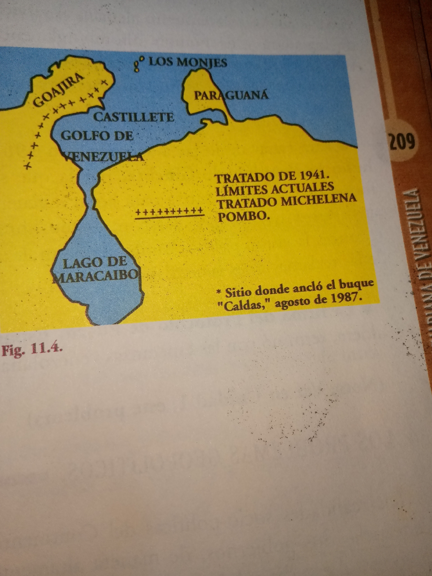
The image is a map of the northern coast of Venezuela, showing the Guajira Peninsula, the Gulf of Venezuela, and Lake Maracaibo. Text on the map labels various locations and historical events. "Los Monjes" and "Paraguaná" are marked in the blue water area. "Castilleto," "Golfo de Venezuela," and "VENEZUELA" are labeled on the landmass. The "Lago de Maracaibo" is a prominent blue area. Textboxes indicate "TRATADO DE 1941. LÍMITES ACTUALES TRATADO MICHELENA POMBO." A note reads "* Sitio donde ancló el buque "Caldas," agosto de 1987." A figure number "Fig. 11.4." is visible in the lower left corner. A vertical text on the right side of the image reads "DIANA DE VENEZUELA." The number "209" is also present on the right edge. The map is illustrated in yellow and blue with black text. The map is slightly angled and appears to be from a book or publication.
Loading AttnAds…
No transactions found