Stake attention in this memory
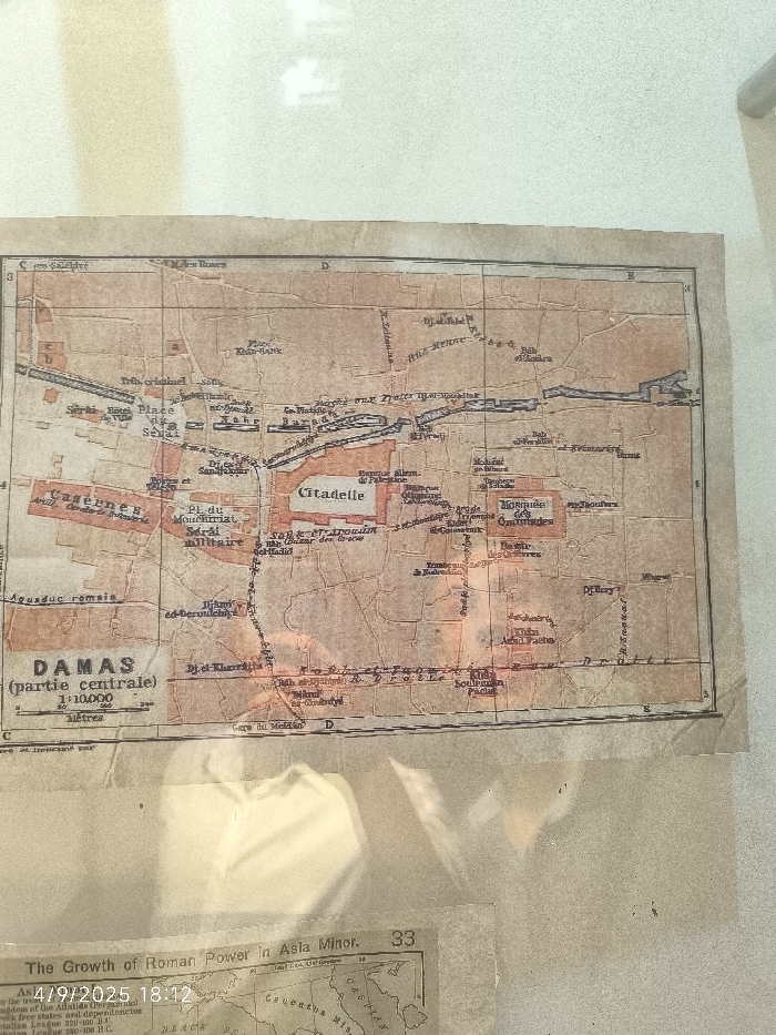
The image displays an overhead photograph of two aged paper documents, likely preserved under a transparent, reflective covering. The primary and most prominent document is a French-language map titled "DAMAS (partie centrale)," indicating it depicts the central part of Damascus, Syria, at a scale of 1:10,000. This map is discolored with a yellowish-brown hue and generalized reddish-brown staining, showing signs of age and wear, including slight creasing. A black grid system with alphanumeric labels (C, D, E and 3, 4, 5) overlays the map. Key city features, highlighted in a reddish-orange color, include the "Citadelle" (Citadel), "Mosquée des Ommayades" (Umayyad Mosque), "Caserne" (Barracks), "Place du Sérai" (Serai Square), "Sérai militaire" (Military Serai), and various souks and gates. An "Aqueduc romain" (Roman aqueduct) is also marked. Partially visible below this map is a second, smaller, older-looking document or map section. Printed text on this lower document reads "The Growth of Roman Power in Asia Minor," with the number "33" in its upper right corner. A digital timestamp, "4/9/2025 18:12," is overlaid in white text on this lower document. The entire arrangement is set against a plain, light-colored, out-of-focus background. No individuals or active interactions are visible.
No transactions found