Sign in
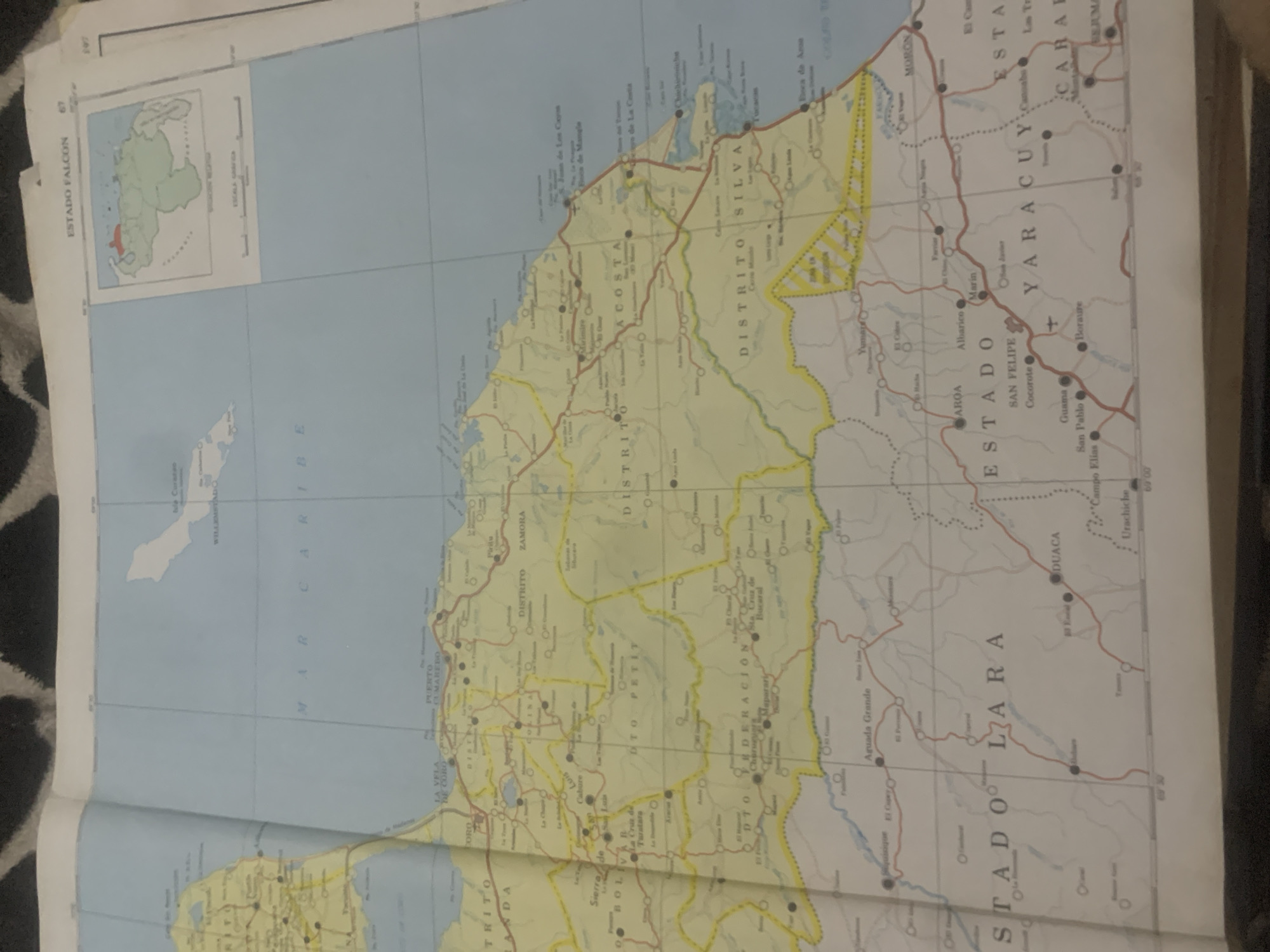
This is a photograph of a map of Venezuela, specifically focusing on the Estado Falcon region. The map is spread open, with the left side depicting the Caribbean Sea and a small inset map showing the location of Estado Falcon within Venezuela. The dominant colors are light blue for the sea and pale yellow for the landmass, crisscrossed with red lines indicating roads and thinner dotted lines representing smaller paths or boundaries.

Numerous place names are visible, including cities, districts, and geographical features. Prominent text labels include "ESTADO FALCON," "MAR CARIBE," "DISTRITO SILVA," "ESTADO YARACUY," and "ESTADO LARA." There are also smaller labels for towns and villages such as "CORO," "MORON," "SAN FELIPE," "AROA," and "PUERTO UMAREBO." Some locations are marked with circles, some larger and some smaller, possibly indicating different sizes of settlements or points of interest. A small cross symbol is visible near "SAN FELIPE."

The map appears to be from a printed atlas or a single-sheet map, given the way it is laid out and the visible edges. The lighting suggests it was photographed indoors, possibly with ambient light. The background shows a dark, textured surface, likely a rug or blanket, on which the map is placed. No people or animals are depicted on the map itself. The overall impression is that of a cartographic document being presented for examination. The location context provided (La Tagua, Venezuela) suggests the map might be relevant to that area, though La Tagua itself is not explicitly labeled on the visible portion of the map.
bombolico

Jun 25, 2026, 2:25 PM

La Tagua, Venezuela

Short Term

Stake attention in this memory

curiosity
nostalgia
adventure
discovery
planning

This is a photograph of a map of Venezuela, specifically focusing on the Estado Falcon region. The map is spread open, with the left side depicting the Caribbean Sea and a small inset map showing the location of Estado Falcon within Venezuela. The dominant colors are light blue for the sea and pale yellow for the landmass, crisscrossed with red lines indicating roads and thinner dotted lines representing smaller paths or boundaries. Numerous place names are visible, including cities, districts, and geographical features. Prominent text labels include "ESTADO FALCON," "MAR CARIBE," "DISTRITO SILVA," "ESTADO YARACUY," and "ESTADO LARA." There are also smaller labels for towns and villages such as "CORO," "MORON," "SAN FELIPE," "AROA," and "PUERTO UMAREBO." Some locations are marked with circles, some larger and some smaller, possibly indicating different sizes of settlements or points of interest. A small cross symbol is visible near "SAN FELIPE." The map appears to be from a printed atlas or a single-sheet map, given the way it is laid out and the visible edges. The lighting suggests it was photographed indoors, possibly with ambient light. The background shows a dark, textured surface, likely a rug or blanket, on which the map is placed. No people or animals are depicted on the map itself. The overall impression is that of a cartographic document being presented for examination. The location context provided (La Tagua, Venezuela) suggests the map might be relevant to that area, though La Tagua itself is not explicitly labeled on the visible portion of the map.

Symbol

93362

Volume

11,550

Creator

+$0.09

Revenue

+$0.12

TVL

$7.27

1D
1W
1M
All

Loading AttnAds…

transactions
revenues
stakers
Earliest
Latest
Highest stake

1

Katy

Staked 10d ago

$7.22 USD

+$0.05 USD

+0.7%

2

Rev Bot 🤖💰

Injected revenue 10d ago

Revenue bonus for the last stake.

+$0.14 USD

More from this user

More from La Tagua

bombolico

Jun 25, 2026, 2:25 PM

La Tagua, Venezuela

Licensed under Creative Commons Attribution 4.0 International License. You are free to share and adapt this content with proper attribution.





