Sign in
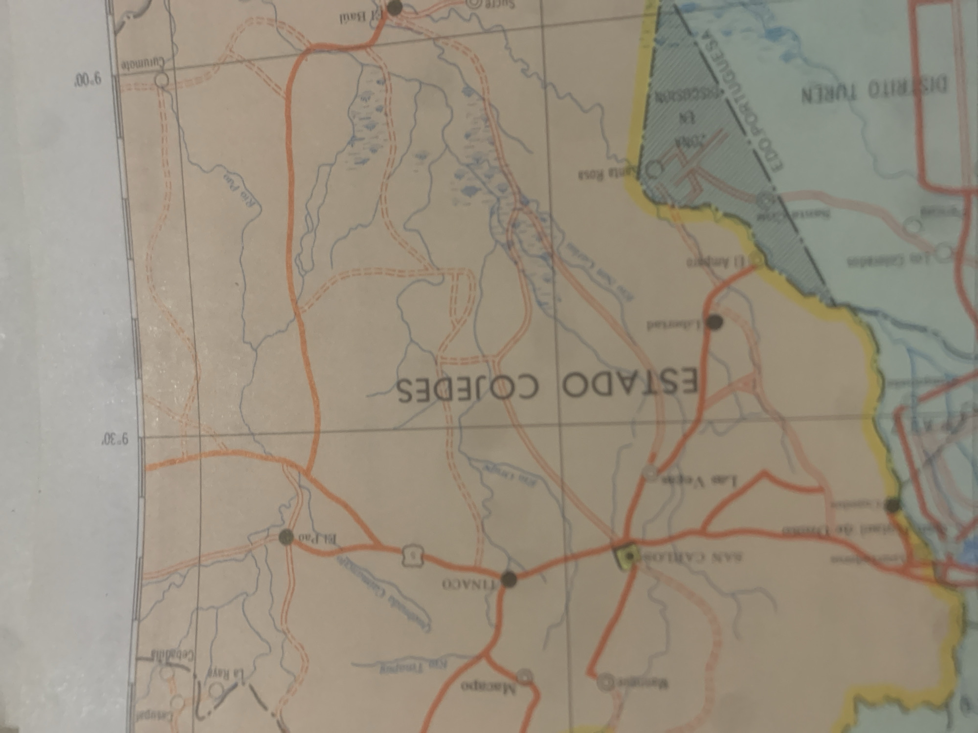
The image is a close-up of a map of Venezuela, showing the states of Cojedes and Portuguesa. The map is oriented vertically, with the top of the image representing a more northerly latitude. Visible text includes place names like "ESTADO COJEDES," "EDO PORTUGUESA," "DISTRITO TUREN," "TINACO," "SAN CARLOS," "Las Vegas," "El Pao," "La Raye," "Cebadilis," "Baúl," "Sucre," "Santa Rosa," "Libertad," "El Amparo," "Curumote," and "Macapo." There are also geographical features indicated, such as rivers labeled "Rio Pao" and "Rio Tuy," and a body of water that appears to be a lake or swampy area. Road networks are depicted with red lines, suggesting highways or major routes. The map includes latitude markings of "9°00'" and "9°30'". The overall impression is that of a cartographic document providing detailed geographical information for the region. There are no people or discernible objects outside of the map itself. The lighting suggests it's an indoor shot, likely taken with a flash or in a well-lit environment, as there are no shadows indicating natural light conditions. The image appears to be a photograph of a printed map, possibly for navigation or geographical study.
bombolico

Jun 25, 2026, 2:46 PM

La Tagua, Venezuela

BLOCKED

Stake attention in this memory

nostalgic
analytical
curious
tranquil
thoughtful

The image is a close-up of a map of Venezuela, showing the states of Cojedes and Portuguesa. The map is oriented vertically, with the top of the image representing a more northerly latitude. Visible text includes place names like "ESTADO COJEDES," "EDO PORTUGUESA," "DISTRITO TUREN," "TINACO," "SAN CARLOS," "Las Vegas," "El Pao," "La Raye," "Cebadilis," "Baúl," "Sucre," "Santa Rosa," "Libertad," "El Amparo," "Curumote," and "Macapo." There are also geographical features indicated, such as rivers labeled "Rio Pao" and "Rio Tuy," and a body of water that appears to be a lake or swampy area. Road networks are depicted with red lines, suggesting highways or major routes. The map includes latitude markings of "9°00'" and "9°30'". The overall impression is that of a cartographic document providing detailed geographical information for the region. There are no people or discernible objects outside of the map itself. The lighting suggests it's an indoor shot, likely taken with a flash or in a well-lit environment, as there are no shadows indicating natural light conditions. The image appears to be a photograph of a printed map, possibly for navigation or geographical study.

Symbol

933F8

Volume

0

Creator

+$0.09

Revenue

+$0.00

TVL

$0.00

1D
1W
1M
All
transactions
revenues
stakers
Earliest
Latest
Highest stake

1

Ramón

Staked 10d ago
Redeemed 9d ago

$7.30 USD

+$0.04 USD

Fee: $0.07 (1%)

+0.5%

2

Rev Bot 🤖💰

Injected revenue 10d ago

Revenue bonus for the last stake.

+$0.20 USD

More from this user

More from La Tagua

bombolico

Jun 25, 2026, 2:46 PM

La Tagua, Venezuela

Licensed under Creative Commons Attribution 4.0 International License. You are free to share and adapt this content with proper attribution.





