Stake attention in this memory
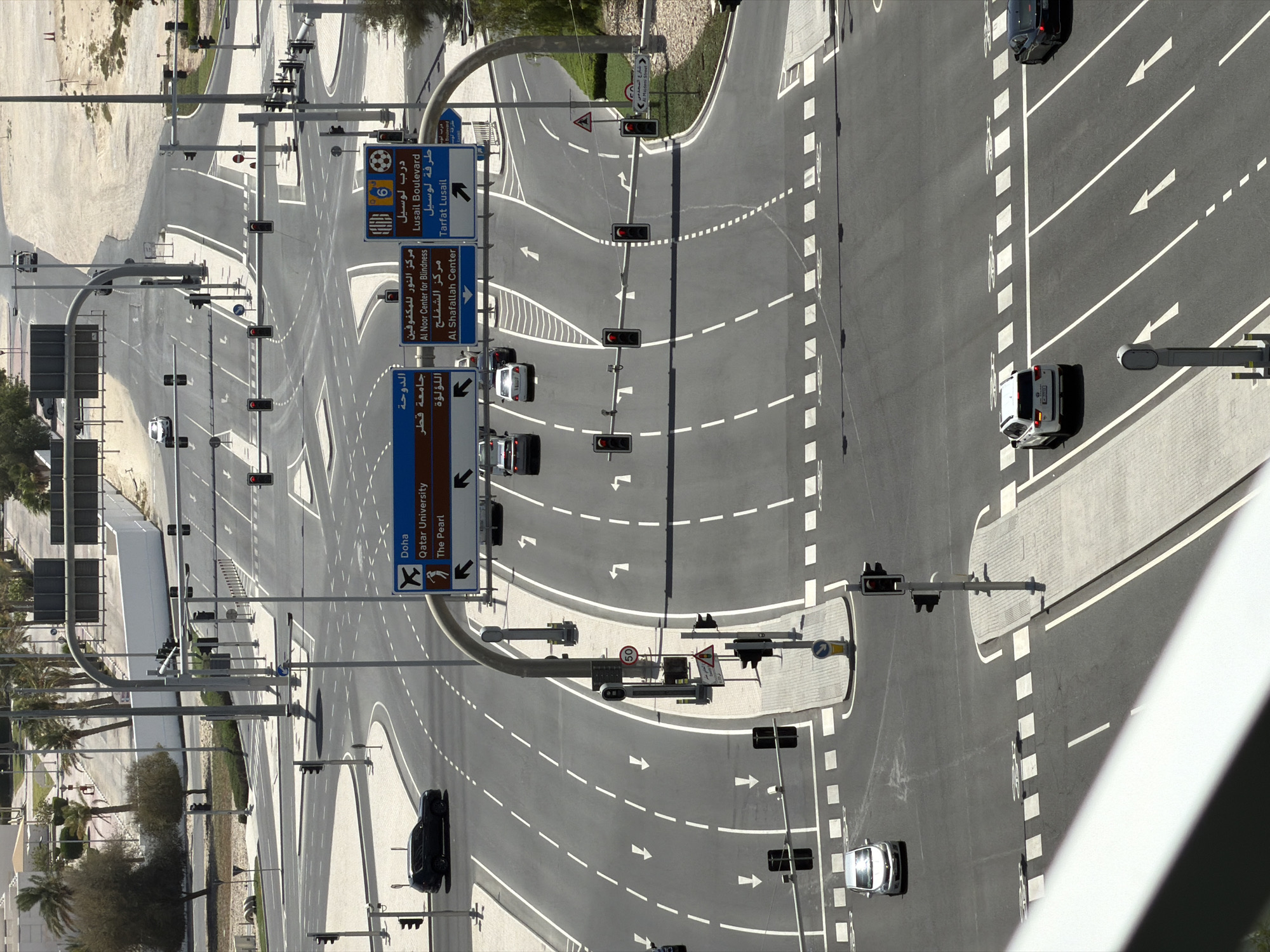
This media file presents an overhead view of a multi-lane road intersection in Lusail, Qatar, captured during bright daylight with clear skies, indicated by strong shadows. The primary subjects are the extensive road network, numerous traffic lights, directional signage, and several vehicles. The intersection features complex road markings, including white dashed and solid lines delineating lanes, turn arrows on the asphalt, and pedestrian crossing symbols. A high density of traffic lights, most appearing red or amber, suggests controlled traffic flow. Several cars, including a white van, a white sedan, and multiple black SUVs, are visible on the different lanes, some seemingly stationary. Notable details include multiple blue and brown road signs providing directions in both Arabic and English. Destinations indicated are "Doha" (with an airplane icon), "Qatar University" (with a university logo), "The Pearl," "Al Noor Center for Blindness," "Al Shafallah Center," "Lusail Boulevard" (with a football icon), and "Tarfat Lusail." A circular red-bordered sign with "50" indicates a speed limit of 50 km/h. Other signs include yield warnings and a triangular hazard sign. The surrounding area features paved sidewalks, streetlights, and some landscaping with palm trees and sparse vegetation, consistent with an urban or suburban setting. No people are visible in the image.
No transactions found