Stake attention in this memory
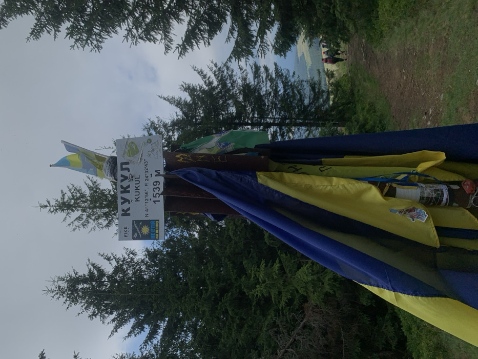
This image depicts the summit marker for Mount Kukol (Kukyl), a peak in the Carpathian Mountains near Vorokhta, Ukraine, identified by the coordinates N 48°12'56", E 24°32'43" and an elevation of 1539 meters. The central subject is a sturdy, dark-colored pole, likely wood or metal, with a white rectangular sign affixed at its top. The sign displays "КУКУЛ" (KUKUL) in Cyrillic, "KUKUL" in Latin script, the geographic coordinates, and the elevation "1539 M". A smaller yellow and blue sign to the left features the text "НЕ СТІЙ НА ШЛЯХУ" (Do Not Stand on the Way) and a stylized symbol. Multiple flags are draped around and attached to the pole. A large blue and yellow flag, representative of Ukraine, is prominently wrapped around the lower portion of the pole, while another, smaller Ukrainian flag is visible at the very top. A green and white flag, along with other less distinct banners, are also affixed. Below the main flags, various small objects, including a cylindrical item wrapped with string and some red components, are tied to the pole. The environment is a mountainous landscape. Tall, dark green coniferous trees frame the scene on both sides and in the background, suggesting a dense forest at elevation. The sky is overcast with light gray clouds. A dirt trail or path extends into the distance on the right side of the image. Along this path, two to three individuals, appearing to be hikers with backpacks, are walking away from the camera into the receding perspective of the trail and the valley beyond. The ground immediately surrounding the pole is covered in green grass and low vegetation.
No transactions found