
Stake attention in this memory
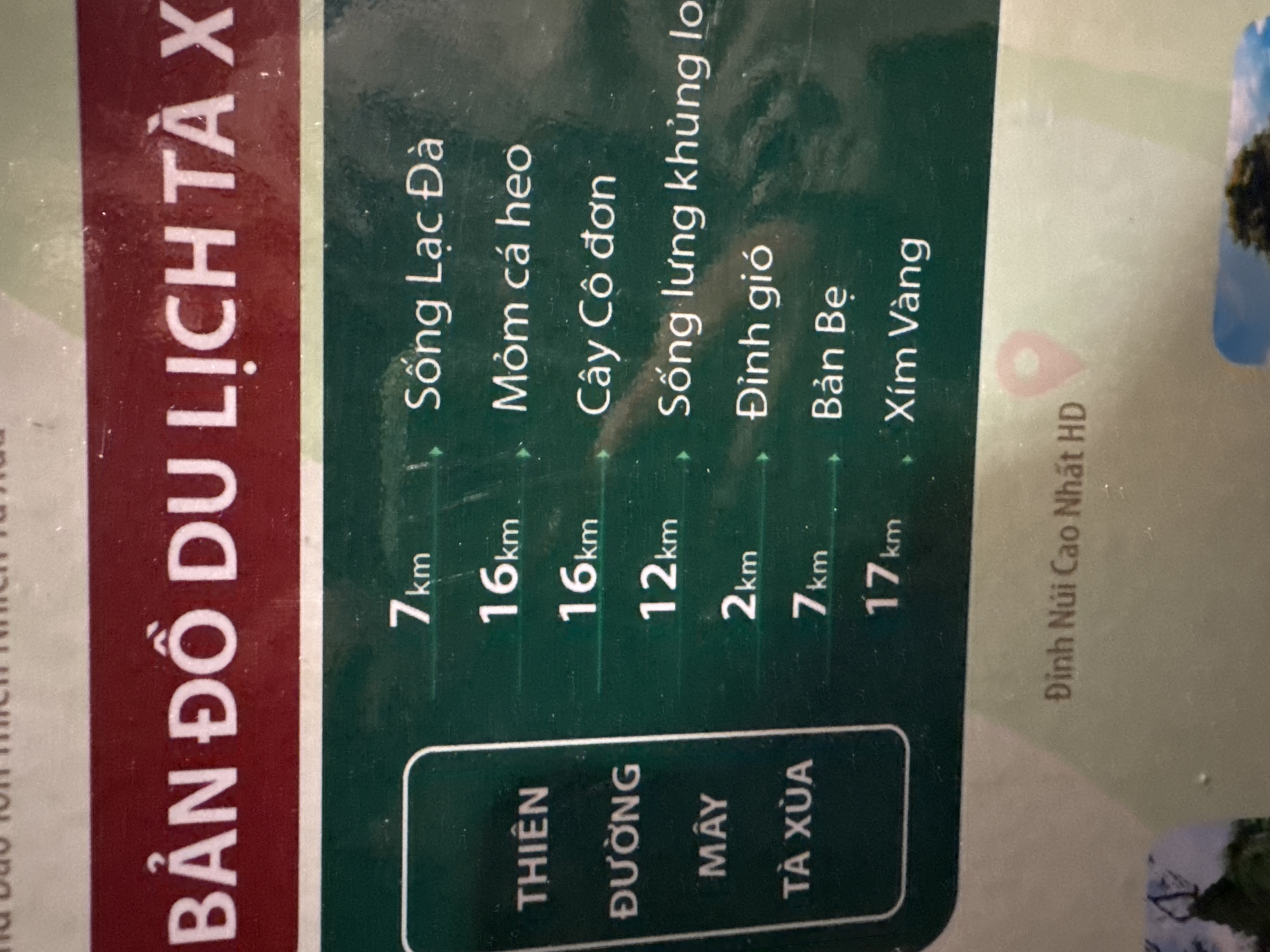
An outdoor informational signboard, likely a tourist map, is prominently displayed in a vertical orientation. The sign features a dark red banner at the top, bearing the white capital Vietnamese text "BẢN ĐỒ DU LỊCH TÀ XÙA" (Ta Xua Tourist Map). Below this banner, the main body of the sign is dark green with white text. On the left side of the green panel, vertically stacked white capital Vietnamese text reads "THIÊN", "ĐƯỜNG", "MÂY", "TÀ XÙA," which translates to "Ta Xua Cloud Paradise" or "Ta Xua Heavenly Road of Clouds." To the right of this column, a list of distances and corresponding destination names is presented: * "7km" next to "Sông Lạc Đà" (Camel River) * "16km" next to "Mỏm cá heo" (Dolphin Snout/Cliff) * "16km" next to "Cây Cô đơn" (Lonely Tree) * "12km" next to "Sống lưng khủng long" (Dinosaur Spine/Backbone) * "2km" next to "Đỉnh gió" (Wind Peak) * "7km" next to "Bản Bẹ" (Ban Be Village) * "17km" next to "Xím Vàng" (Xim Vang) Below the main green panel, a lighter green or grey section contains the white text "Đỉnh Núi Cao Nhất HD" (Highest Mountain Peak HD), accompanied by a red map pin icon, indicating a specific location on a map. The sign's surface shows minor reflections and some faint scuffs or dust, suggesting an outdoor environment. No people or other active subjects are visible in the frame, which is a close-up photograph of the signboard. The overall appearance is matter-of-fact and functional, typical of public information signage.
Loading AttnAds…
No transactions found