Stake attention in this memory
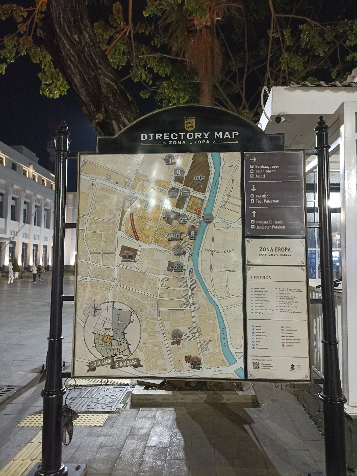
The image displays a prominent directory map at night, guiding visitors through the "Zona Eropa" (European Zone) of Kota Lama Surabaya, Indonesia. The map is mounted on a dark metal stand, with a decorative lamppost on the left. The top of the map sign reads "DIRECTORY MAP ZONA EROPA," and "KOTA LAMA SURABAYA" is inscribed at the bottom left of the map section. The map itself illustrates a detailed street layout, a river labeled "CHINESE KAMP" along its bank, and various landmarks denoted by icons. To the right of the main map, a panel lists key destinations with directional arrows, including "Nembang Jepun," "Pasar Pabean," "Ampel," "Pos Bloc," "Tugu Pahlawan," "Penjara Kalisosok," and "Jembatan Petekan." Below this, text reads "ZONA EROPA KOTA LAMA S. BARRYA" and "LEGENDA" (Legend). The scene is illuminated by artificial lighting, indicating it's nighttime. In the background, a large tree with visible branches and foliage stands against the dark sky. To the left, a row of elegant, light-colored buildings with distinct architecture, possibly of European colonial style, are lit up. A few blurry figures can be seen walking on the paved ground in front of these buildings. The foreground features a paved walkway with tactile paving strips. An object, possibly a small bag, hangs from the lamppost on the left. The overall ambiance is calm and well-lit, typical of a historical district at night.
No transactions found