
Sign in
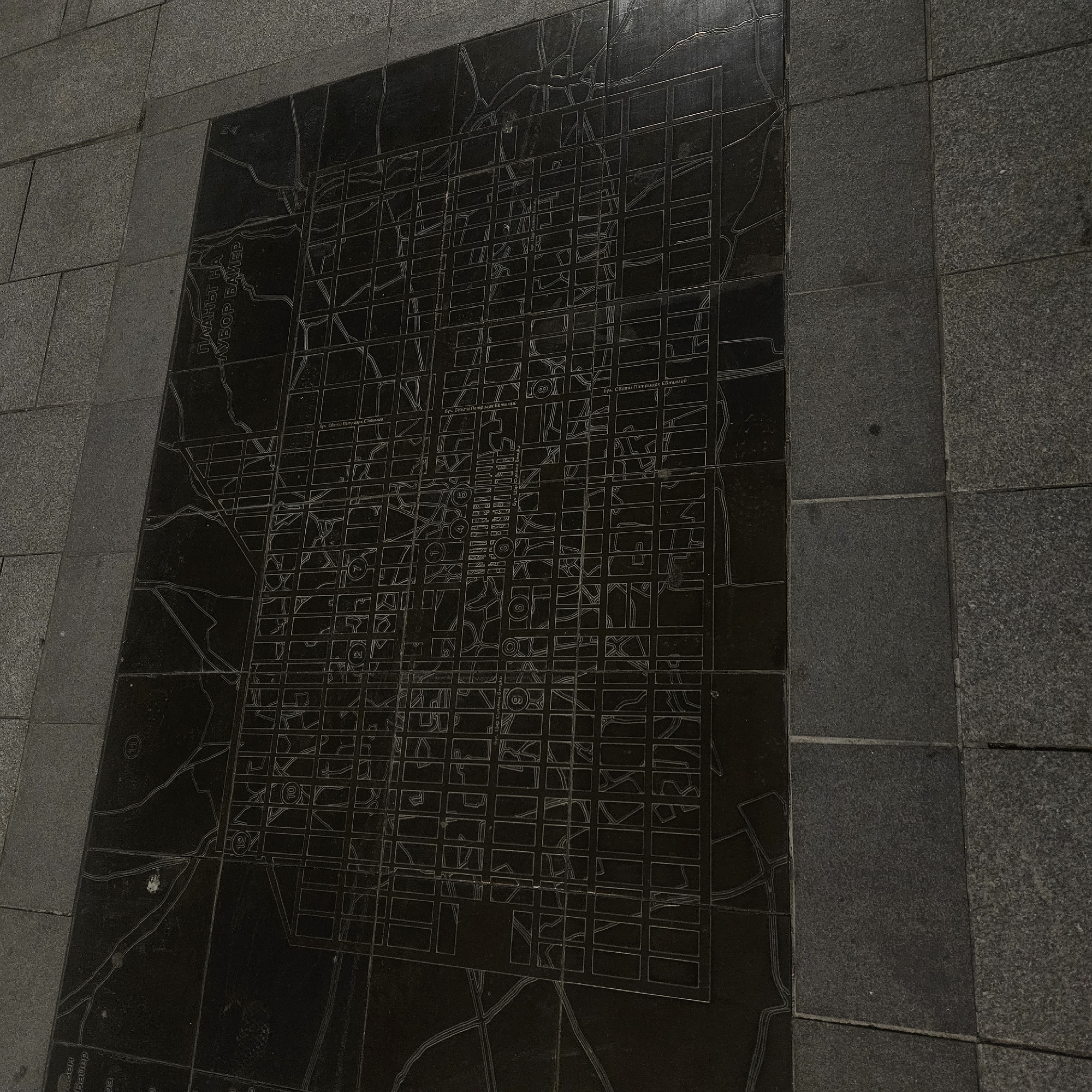
The image displays a large, dark, polished stone slab embedded within a gray, textured stone pavement. The slab, likely granite or marble, features an intricate, etched map or grid pattern of a city, with streets and building blocks outlined in lighter lines against the dark background.

The etched design clearly shows a street network, with both an orthogonal grid system and more organic, curving routes. Several sections of text in Cyrillic script are visible, identifying street names. Notable street names include "ПЛАНЪТ НА" (The Plan of), "БУЛ. БАТЕНБЕРГ" (Bul. Batenberg – Batenberg Boulevard), "Бул. Свети Патриарх Евтимий" (Bul. Sveti Patriarh Evtimiy – Saint Patriarch Euthymius Boulevard), and "Бул. ЦАР Симеон Велики" (Bul. Tsar Simeon Veliki – Tsar Simeon the Great Boulevard). Small numbers encircled, such as 1, 2, 7, 10, and 80, are placed within certain blocks or intersections, likely indicating specific locations or zones on the map.

No direct activity or people are present in the scene. The image captures a static urban feature, possibly a public art installation or an informational map for pedestrians. The lighting suggests daytime, possibly overcast or late in the day, with soft, even illumination and no harsh shadows. The stone surfaces appear dry. Given the provided context, this map likely represents a plan of the city of Stara Zagora, Bulgaria.
Tihomir Angelov

Apr 29, 2026, 7:42 PM

Stara Zagora, Bulgaria

Stake attention in this memory

historical
intricate
urban
navigational
detailed

The image displays a large, dark, polished stone slab embedded within a gray, textured stone pavement. The slab, likely granite or marble, features an intricate, etched map or grid pattern of a city, with streets and building blocks outlined in lighter lines against the dark background. The etched design clearly shows a street network, with both an orthogonal grid system and more organic, curving routes. Several sections of text in Cyrillic script are visible, identifying street names. Notable street names include "ПЛАНЪТ НА" (The Plan of), "БУЛ. БАТЕНБЕРГ" (Bul. Batenberg – Batenberg Boulevard), "Бул. Свети Патриарх Евтимий" (Bul. Sveti Patriarh Evtimiy – Saint Patriarch Euthymius Boulevard), and "Бул. ЦАР Симеон Велики" (Bul. Tsar Simeon Veliki – Tsar Simeon the Great Boulevard). Small numbers encircled, such as 1, 2, 7, 10, and 80, are placed within certain blocks or intersections, likely indicating specific locations or zones on the map. No direct activity or people are present in the scene. The image captures a static urban feature, possibly a public art installation or an informational map for pedestrians. The lighting suggests daytime, possibly overcast or late in the day, with soft, even illumination and no harsh shadows. The stone surfaces appear dry. Given the provided context, this map likely represents a plan of the city of Stara Zagora, Bulgaria.

Loading AttnAds…

transactions
revenues
stakers
Earliest
Latest
Highest stake

No transactions found

More from this user

More from Stara Zagora

Tihomir Angelov

Apr 29, 2026, 7:42 PM

Stara Zagora, Bulgaria

Licensed under Creative Commons Attribution 4.0 International License. You are free to share and adapt this content with proper attribution.