Sign in
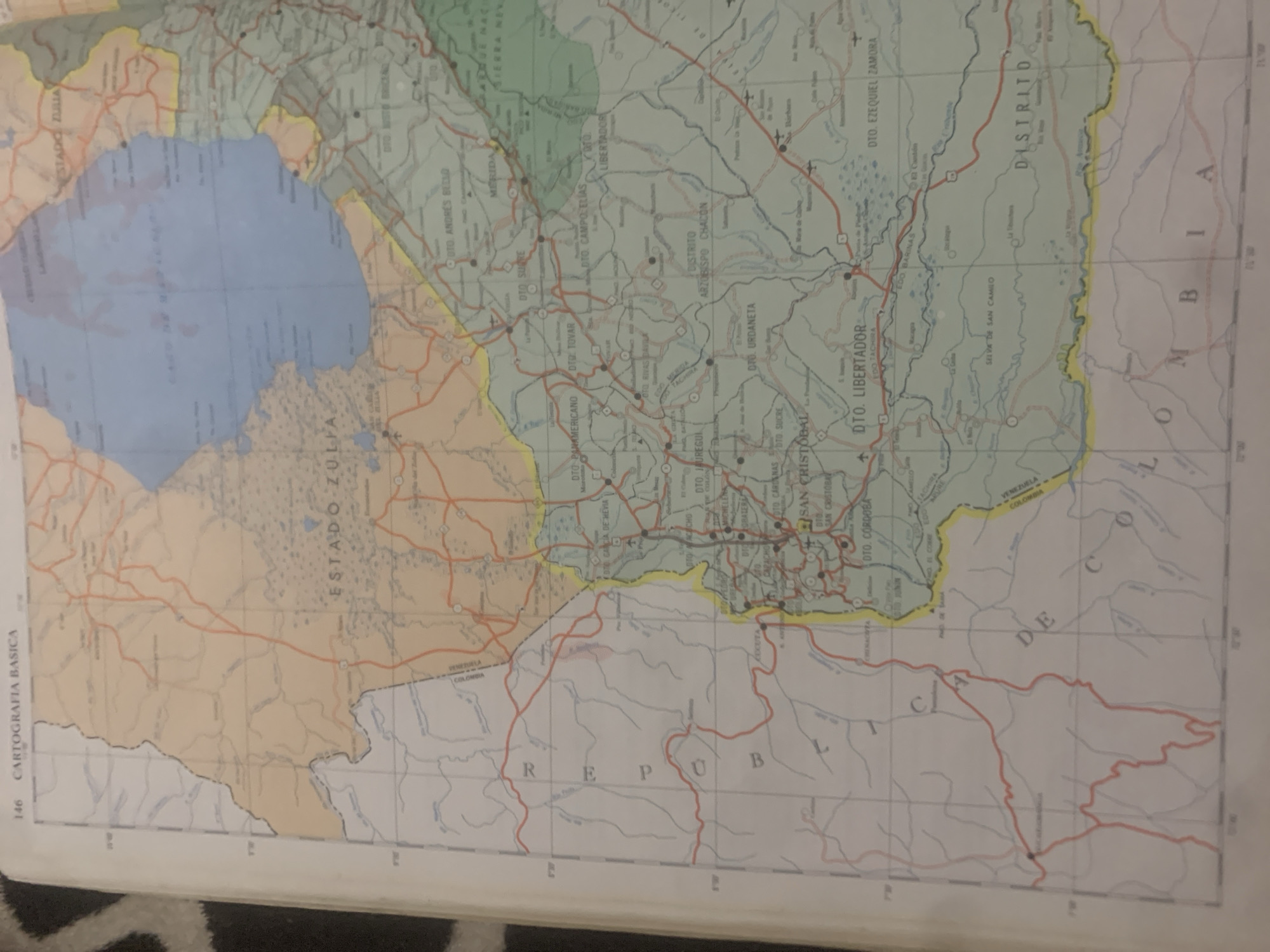
The image is a photograph of a map, likely from an atlas or a wall map, depicting a region of Venezuela and bordering Colombia. The map shows political boundaries, cities, towns, roads, rivers, and geographical features like lakes and mountains. The primary subjects are the cartographic elements themselves.

The map's title "CARTOGRAFIA BASICA" is visible on the left edge, indicating it's a basic cartographic representation. Several Venezuelan states and districts are labeled, including "ESTADO ZULIA," "MERIDA," "DISTRITO ARZOBISPO CHACON," and "DISTRITO." The border with Colombia is clearly marked, with "COLOMBIA" and "VENEZUELA" labeled near the frontier. Various towns and cities such as "SAN CRISTOBAL," "CRISTOBAL," and "LA TAGUA" (though "LA TAGUA" is not explicitly visible, it's provided as a location context) are indicated with dots and names. Roads are shown as orange lines, and rivers as blue lines. The map's orientation is such that the top of the image is tilted to the left.

There are no people, objects, or specific activities depicted other than the cartographic information presented. The scene is static, showing a geographical representation of an area. The time of day and weather are not applicable to a map. The prominent text includes place names, state and district designations, and the title "CARTOGRAFIA BASICA."
bombolico

Jun 25, 2026, 2:48 PM

La Tagua, Venezuela

BLOCKED

Stake attention in this memory

nostalgic
analytical
scholarly
curious
contemplative

The image is a photograph of a map, likely from an atlas or a wall map, depicting a region of Venezuela and bordering Colombia. The map shows political boundaries, cities, towns, roads, rivers, and geographical features like lakes and mountains. The primary subjects are the cartographic elements themselves. The map's title "CARTOGRAFIA BASICA" is visible on the left edge, indicating it's a basic cartographic representation. Several Venezuelan states and districts are labeled, including "ESTADO ZULIA," "MERIDA," "DISTRITO ARZOBISPO CHACON," and "DISTRITO." The border with Colombia is clearly marked, with "COLOMBIA" and "VENEZUELA" labeled near the frontier. Various towns and cities such as "SAN CRISTOBAL," "CRISTOBAL," and "LA TAGUA" (though "LA TAGUA" is not explicitly visible, it's provided as a location context) are indicated with dots and names. Roads are shown as orange lines, and rivers as blue lines. The map's orientation is such that the top of the image is tilted to the left. There are no people, objects, or specific activities depicted other than the cartographic information presented. The scene is static, showing a geographical representation of an area. The time of day and weather are not applicable to a map. The prominent text includes place names, state and district designations, and the title "CARTOGRAFIA BASICA."

Symbol

98DAC

Volume

11,550

Creator

+$0.09

Revenue

+$0.13

TVL

$7.40

1D
1W
1M
All
transactions
revenues
stakers
Earliest
Latest
Highest stake

1

RIKO

Staked 10d ago

$7.35 USD

+$0.05 USD

+0.7%

2

Rev Bot 🤖💰

Injected revenue 10d ago

Revenue bonus for the last stake.

+$0.14 USD

More from this user

More from La Tagua

bombolico

Jun 25, 2026, 2:48 PM

La Tagua, Venezuela

Licensed under Creative Commons Attribution 4.0 International License. You are free to share and adapt this content with proper attribution.