Stake attention in this memory
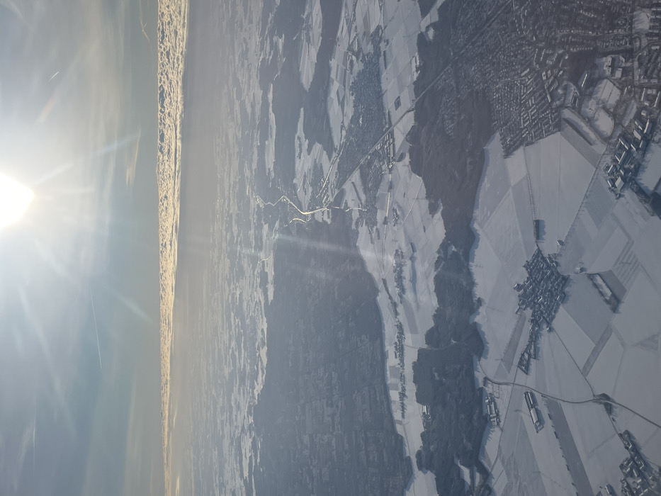
An aerial photograph captures a snow-covered winter landscape, likely taken from an aircraft. The sun, prominent in the upper right, casts intense flares and streaking rays across the scene. The sky above is clear blue, while a distinct, elongated band of stratified clouds spans the distant horizon, approximately one-third of the way up from the bottom edge. A faint contrail is visible in the upper left quadrant. The terrain below is extensively covered in snow, appearing white and textured, with darker areas indicating exposed land or dense forestation. A prominent river, the Isar River, flows from the top-middle of the frame towards the bottom-right, visible as a darker, winding line against the snow. Parallel to the Isar River on its western bank, a major highway (likely Bundesstraße 11 or Autobahn 92) traverses the landscape, appearing as a bright, linear feature reflecting sunlight. The city of Freising, Germany, is identifiable in the bottom-right quadrant of the image as a sprawling urban area with a high density of buildings and a discernible street network. Buildings and rooftops within Freising are covered in snow. Smaller villages and hamlets, characterized by clusters of structures amidst snow-covered agricultural fields, are scattered throughout the mid-ground and foreground. Patches of dark green/brown forests punctuate the landscape, contrasting with the white snow. No individuals are discernible within the frame due to the high altitude.
Loading AttnAds…
No transactions found