Stake attention in this memory
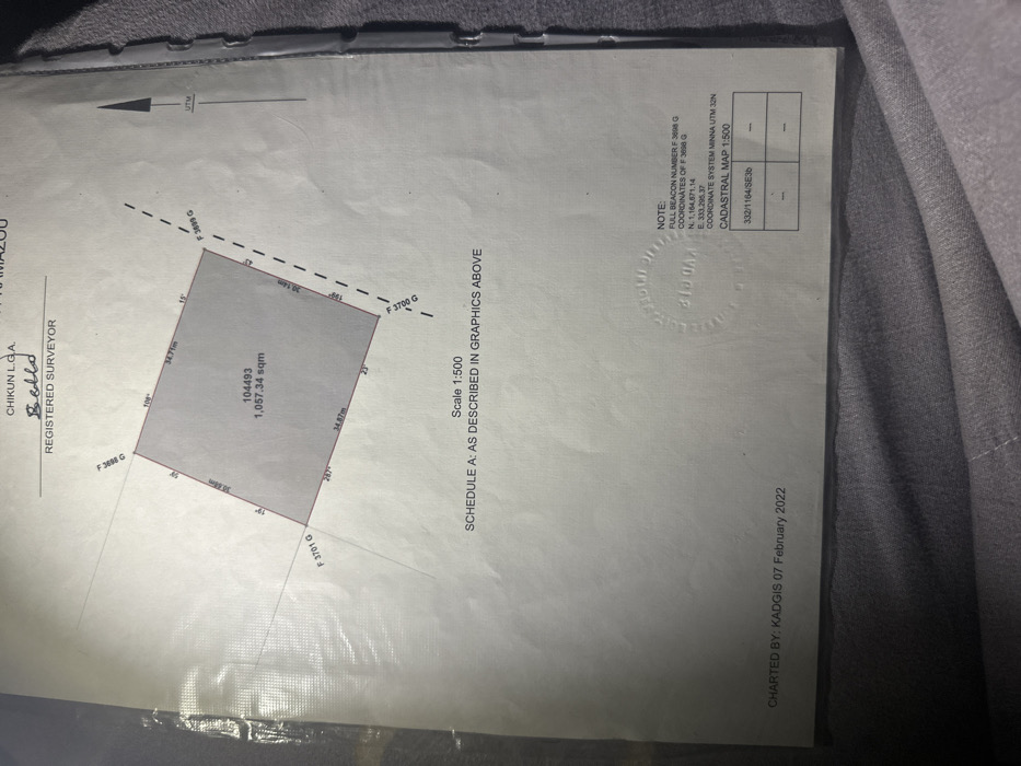
The image displays a cadastral map or land survey document for plot 104493, encompassing an area of 1,057.34 square meters, situated in Chikun Local Government Area, which includes the city of Rido, Nigeria. The plot's boundaries are delineated by four segments measuring 34.71m, 30.86m, 34.87m, and 30.16m, with associated bearings of 108°, 19°, 287°, and 196° respectively. Key beacon points are identified as F 3698 G, F 3701 G, F 3700 G, and F 3699 G. Coordinates for beacon F 3698 G are N: 1,164,871.14 and E: 295,395.37, specified under the UTM Minna Zone 32N coordinate system. The map is drawn to a scale of 1:500 and carries a cadastral map reference of 332/1164/SE3b. The document states "CHARTED BY: KADGIS 07 February 2022," and a handwritten signature "Bello" appears above the "REGISTERED SURVEYOR" title. An embossed seal, consistent with KADGIS, is partially visible on the lower right quadrant of the document. The map itself shows minor creasing and is partially covered by a reflective plastic sheet on its left edge, resting on a textured, light grey fabric surface.
No transactions found