Stake attention in this memory
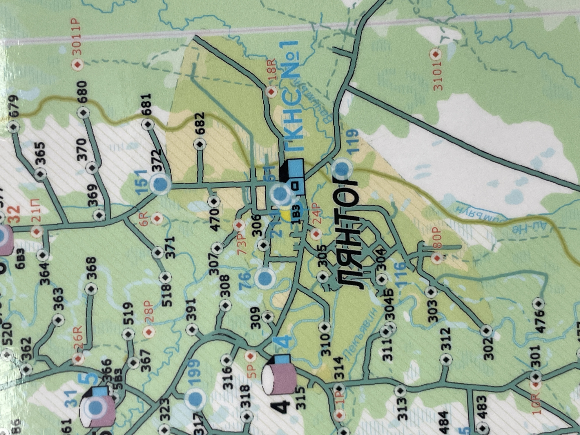
This is a detailed, close-up aerial map of a section of Solnechnyi, Russia, specifically focusing on a forest and an industrial or infrastructure area. The map shows numerous numbered locations, roads, and bodies of water. Key features include: * **Roads and Paths:** A network of paved and unpaved roads is depicted, indicated by thick black lines. Some roads have markers with numbers like "31", "4", "199", "315", "314", "311", "312", "301", "10R", "304B", "304", "116", "303", "80P", "119", "1B3", "24P", "18R", "305", "306", "73P", "76", "309", "308", "307", "470", "391", "318", "316", "5P", "367", "28P", "5B3", "366", "323", "317", "519", "28P", "371", "518", "368", "26R", "363", "364", "6B3", "32", "21П", "365", "370", "369", "372", "151", "681", "682", "372", "680", "3011P", "3101O", "679", and "86". * **Buildings and Structures:** There are depictions of buildings. A prominent blue building complex labeled "ГКНС №1" (GKNS No. 1) is visible, suggesting a gas pumping station or similar facility. Other structures are indicated by smaller shapes, some with circles suggesting points of interest. * **Water Features:** Several bodies of water are shown, represented by light blue shapes. These appear to be lakes, ponds, or possibly marshy areas within the forest. * **Vegetation:** The majority of the map is colored green, indicating forest or wooded areas. Some areas are depicted with lighter green or white, suggesting clearings, fields, or possibly water. * **Labels:** Various labels are present, including "Лянтор" (Lyantor), likely the name of a settlement or area, and what appear to be river or stream names like "Пекъявин" (Pekyavin) and "Румьян" (Rumyan). There is also a label "Ац-Не" (Ats-Ne). The map is detailed and appears to be a navigational aid for a specific geographic area, focusing on infrastructure and natural landmarks within a forest setting.
Symbol
9F290
Volume
11,550
Creator
+$0.25
Revenue
+$0.00
TVL
$24.75
More from Solnechnyi