Stake attention in this memory
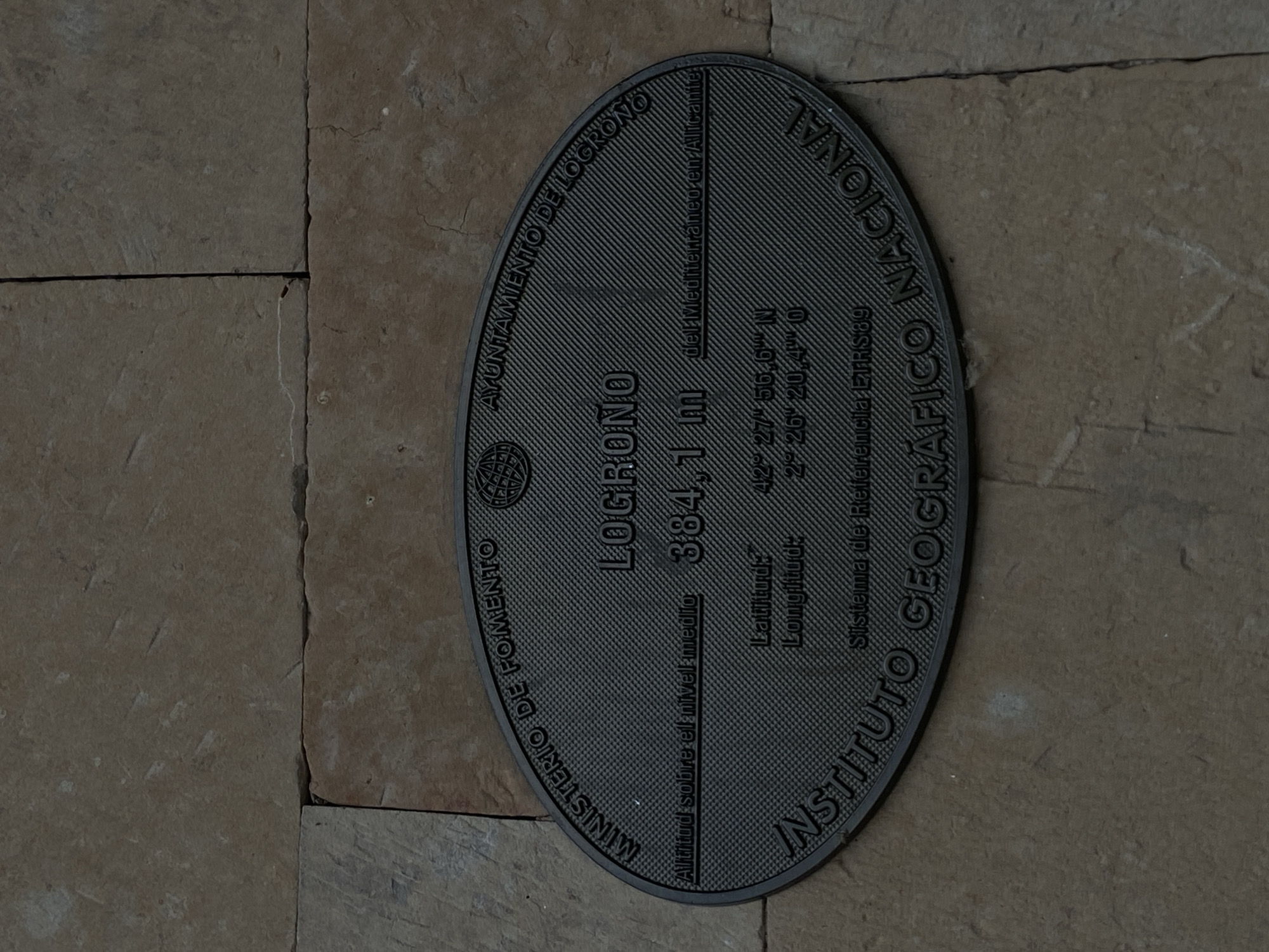
The image shows a dark, oval-shaped plaque attached to a stone wall. The plaque is embossed with text and a globe logo. The text on the plaque indicates that it is located in Logroño, Spain. It states the altitude of Logroño as 384.1 meters above the Mediterranean Sea in Alicante, and provides latitude and longitude coordinates: 42° 27' 56.6" N and 2° 26' 20.4" O. The plaque also bears the names "MINISTERIO DE FOMENTO", "AYUNTAMIENTO DE LOGROÑO", and "INSTITUTO GEOGRÁFICO NACIONAL", and "Sistema de Referencia ETRS89". The wall appears to be constructed of large, rectangular stone blocks in varying shades of brown and tan. The lighting suggests an outdoor setting, possibly during the day, with some shadows visible. There are no people or animals present in the image.
No transactions found