Stake attention in this memory
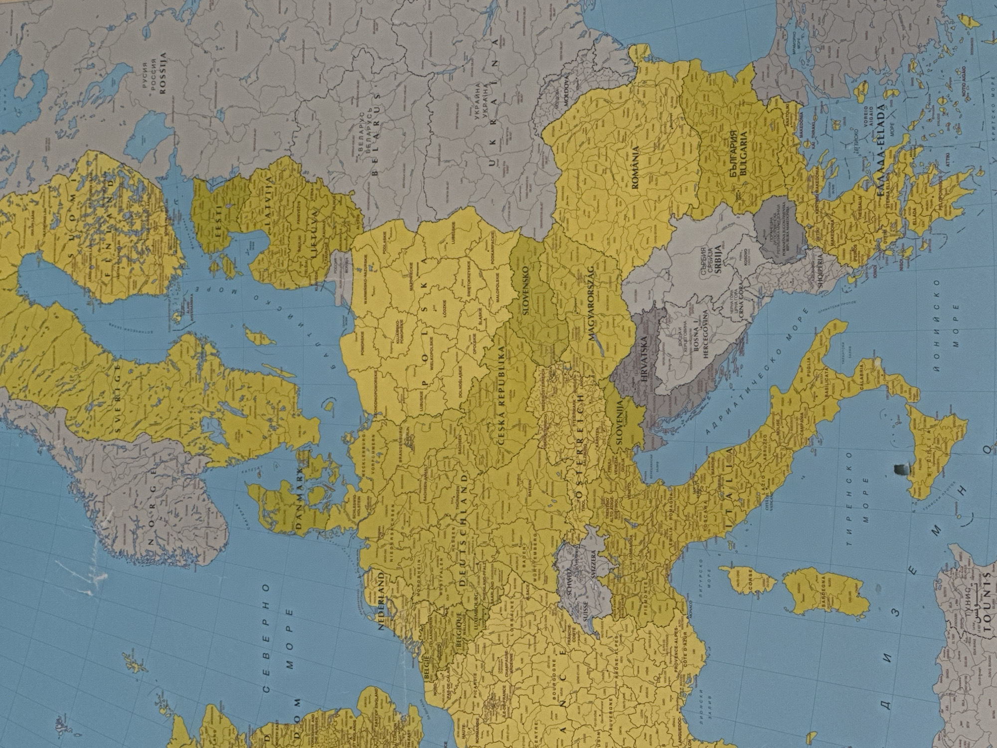
The image displays a detailed political map of Europe, presented from an overhead perspective. Landmasses are predominantly colored in yellow and grey, indicating distinct political classifications, while bodies of water are blue. Countries identified in yellow include most of Western, Central, and Southern Europe, as well as Scandinavia, consistent with European Union or Schengen Area membership. Grey countries include Norway, Switzerland, the United Kingdom, Belarus, Ukraine, Russia, Moldova, and various Balkan nations such as Serbia and Albania. The map features numerous labels in both Latin and Cyrillic scripts for countries, major cities (marked with black dots), significant rivers, and seas. Examples of bilingual labels include "РОССИЯ / ROSSIJA" for Russia and "БЪЛГАРИЯ / BULGARIA" for Bulgaria. National borders are clearly delineated with thin black lines, and some internal administrative divisions are also visible within larger countries. Latitude and longitude lines are faintly visible across the blue ocean areas. The environment depicted is strictly geographical and political. No people are visible, and no actions or interactions are taking place within the static map image. Regarding Tutrakan, Bulgaria: The city is located in northern Bulgaria, specifically on the southern bank of the Danube River. It is positioned east of the larger city of Ruse and west of Silistra, close to Bulgaria's border with Romania. Tutrakan is marked by a small black dot and labeled in Cyrillic script (ТУТРАКАН) on the map.
No transactions found