
Stake attention in this memory
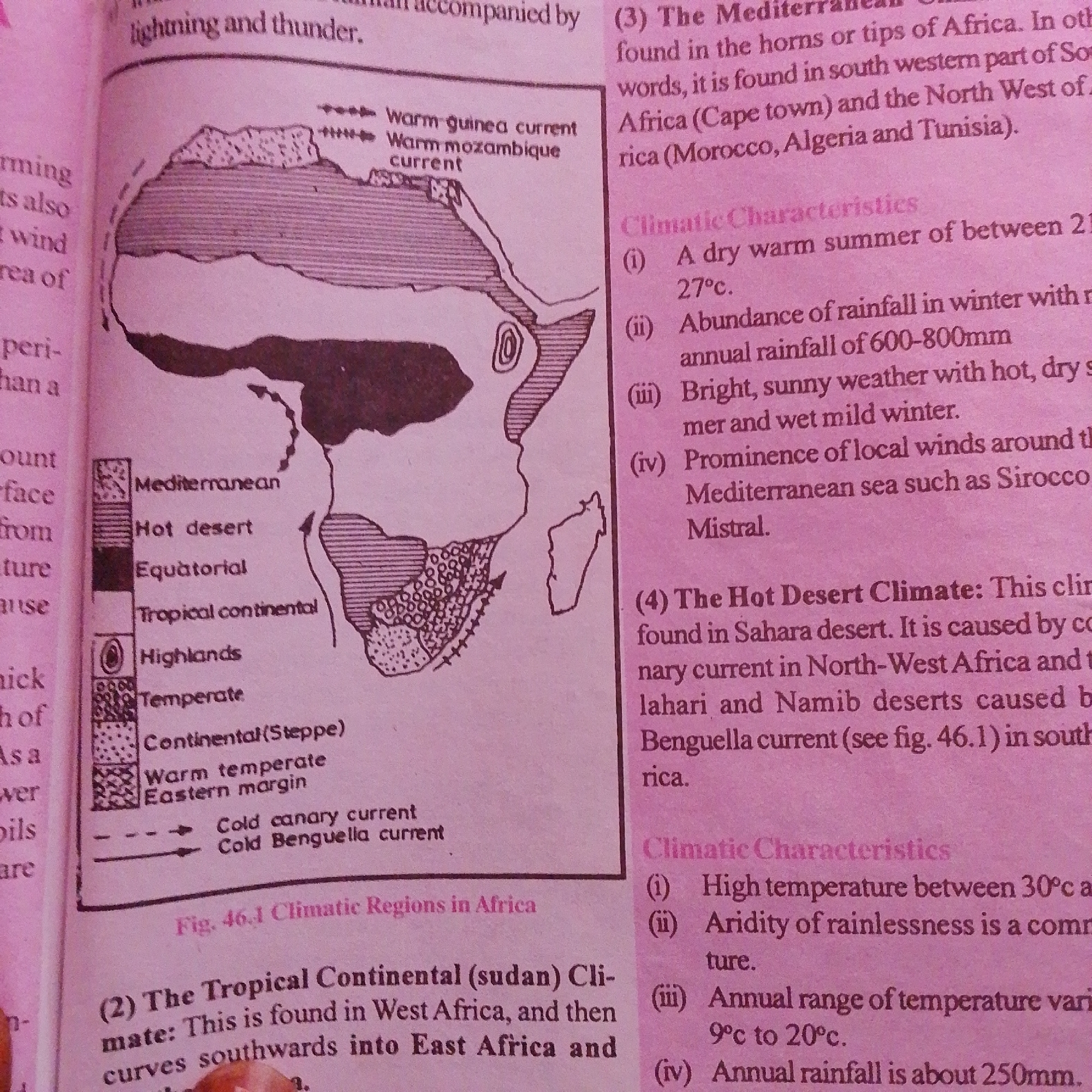
This is a close-up, overhead shot of an open textbook page, depicting a map of Africa with various climate regions and accompanying text. The map uses different shading patterns to denote Mediterranean, Hot desert, Equatorial, Tropical continental, Highlands, Temperate, and Continental (Steppe) climates. Arrows indicate warm guinea current and warm Mozambique current. Text to the left of the map labels these regions and also mentions "lightning and thunder" and "warm equatorial". To the right of the map, detailed descriptions of Mediterranean and Hot Desert climates are provided, including their climatic characteristics. The text also mentions specific locations within Africa like Cape Town, Morocco, Algeria, Tunisia, and the Sahara Desert. There is a figure number "Fig. 46.1 Climatic Regions in Africa" below the map. The image is well-lit, suggesting it was taken in a well-lit environment, possibly indoors. The page is slightly creased and aged, indicative of a used textbook. There are no people or a specific scene visible, only the educational content of the book. The location context of Jalingo, Nigeria, doesn't directly inform the content of the image itself, which focuses on African geography and climate.
Symbol
A21B2
Volume
4,987
Creator
+$0.01
Revenue
+$0.01
TVL
$0.55
Loading AttnAds…

2

Rev Bot 🤖💰
Injected revenue 1mo ago
“Revenue bonus for the last stake.”
+$0.01 USD