Stake attention in this memory
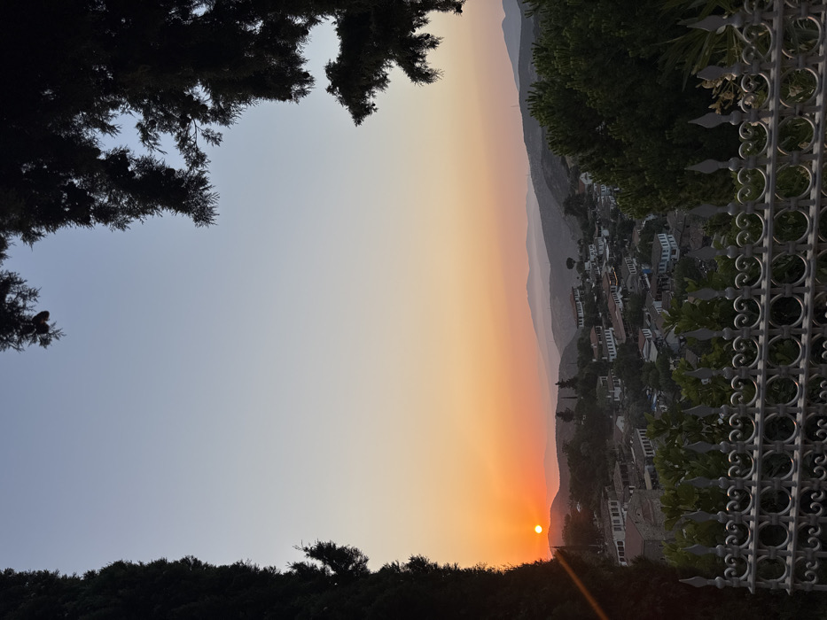
The image displays an elevated view of Şirince Village, located approximately 8 kilometers east of Selçuk, Turkey, during sunset. The sky transitions from a pale blue at the top to vibrant orange and red hues near the horizon, where the setting sun, a bright orange orb, is visible slightly left of center, partially obscured by distant hills. In the midground, the village of Şirince is visible, nestled within a valley. It consists of numerous traditional white or light-colored houses with dark-tiled roofs, interspersed with green trees and vegetation. A prominent domed structure, resembling a church, is discernible on the left side of the village. The background features layers of hazy rolling hills and mountains receding into the distance. The immediate foreground includes a decorative, light-colored metal fence with ornate patterns and spiked finials running horizontally across the bottom. Behind this fence, green foliage from bushes or smaller trees is present. The left edge of the frame is bordered by the dark silhouette of a tall, narrow tree, likely a cypress. The upper right corner is framed by the dark, silhouetted branches of a coniferous tree. No people, actions, or interactions are depicted.
Symbol
A2A51
Volume
0
Creator
+$0.01
Revenue
+$0.00
TVL
$0.00