
Stake attention in this memory
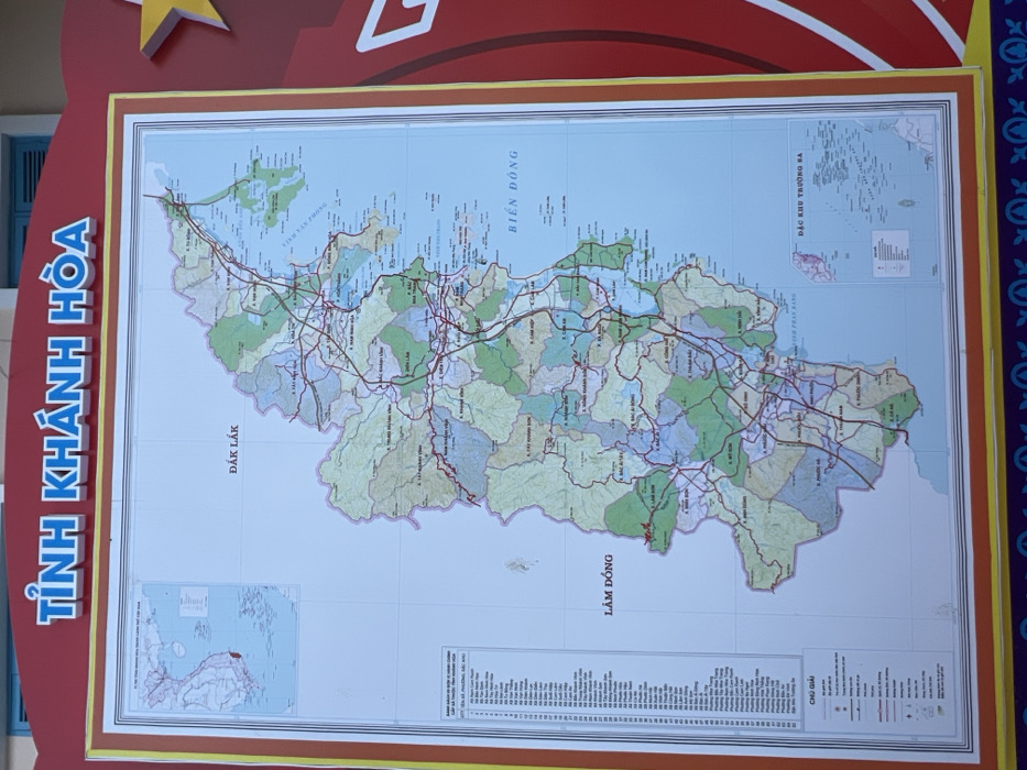
A large, vertically oriented map of Khánh Hòa Province, Vietnam, is prominently displayed. The map is framed by red and yellow borders, with the title "TỈNH KHÁNH HÒA" in raised blue Vietnamese lettering across the top. The map details the administrative divisions, major roads (depicted by red lines), and geographical features of the province. Neighboring provinces ĐẮK LẮK and LÂM ĐỒNG are labeled on the western side, and the "BIỂN ĐÔNG" (East Sea/South China Sea) is indicated along the eastern coast. Two inset maps are present: one in the upper left corner showing Vietnam with Khánh Hòa highlighted in red, and another in the lower right detailing the "ĐẶC KHU TRƯỜNG SA" (Spratly Islands Special Administrative Region). A legend ("CHÚ GIẢI") and a list of administrative units are positioned on the left side of the main map. The display is part of a larger structure, with a red panel featuring a partial star-like or decorative element visible on the right, and a blue patterned border at the bottom. Above the map, a light blue wall or ceiling and a dark blue window frame are visible. The scene depicts a stationary informational display, consistent with public installations found in government buildings, information centers, or schools within Nha Trang, the capital city of Khánh Hòa Province. No individuals or actions are present.
Loading AttnAds…
No transactions found