Stake attention in this memory
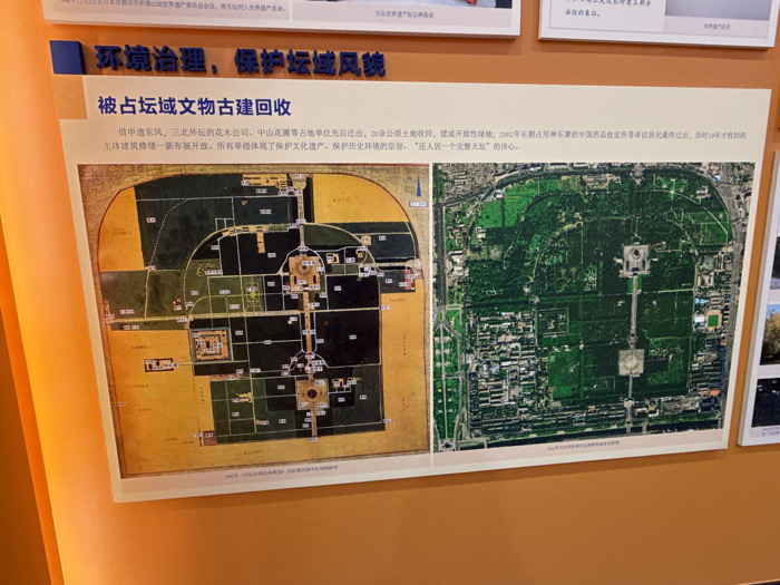
The image shows two maps on a wall in an orange-colored room, located at the coordinates latitude: 39.882, longitude: 116.407, in Beijing, China. The left map is an older, hand-drawn version, depicting a large, walled city with many smaller buildings, some of which are labeled with numbers. It's set against a yellow background and has a curved shape, suggesting a layout of a Forbidden City. The right map is a more modern aerial photograph of the same walled city, with buildings, roads, and trees clearly visible. It is surrounded by a gray wall. The aerial photo shows a large, rectangular building surrounded by green vegetation and surrounded by a larger rectangular area of similar vegetation with roads circling it. The title above the maps reads "Environmental Protection, Protecting Historical Sites." The text under the maps is in Chinese and describes the significance of the site.
Loading AttnAds…
No transactions found