Stake attention in this memory
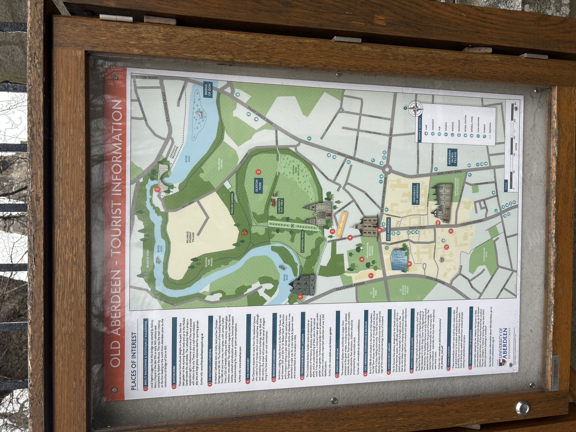
The image shows a wooden-framed tourist information board displaying a map of Old Aberdeen, a historical part of Aberdeen City, United Kingdom. The map outlines key points of interest, including the Brig o' Balgownie, Seaton Park, St Machar's Cathedral, the Chanonry, Benholm's Lodging, Cruickshank Botanic Garden, the Zoology Museum, the Old Aberdeen Town House & Museum, the Duncan Rice Library, King's College & Chapel, the Powis Gateway, and Crombie Halls of Residence. The map also indicates the locations of various shops and services such as cafes, takeaways, pubs, churches, mosques, bookshops, petrol stations, general stores, cash machines, and chemists. The information board features text descriptions for each point of interest, providing historical context and details. The River Don winds through the map, and the University of Aberdeen logo is displayed at the bottom. The environment around the board includes a gray metallic object.
No transactions found