
Sign in
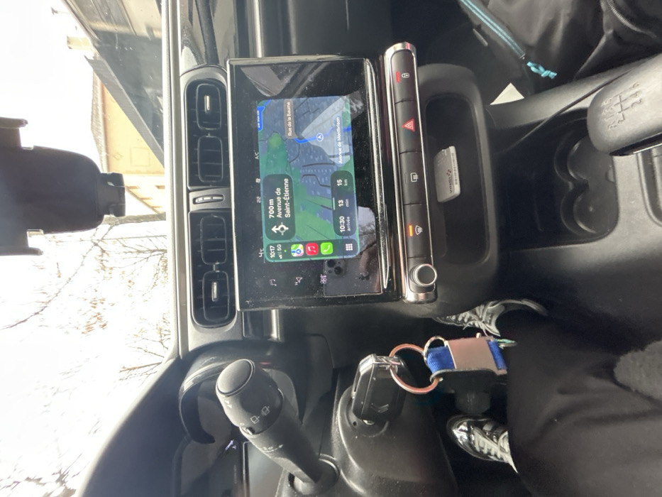
The image presents an interior view from a vehicle, primarily focusing on the dashboard and central console. A person's left leg, wearing black pants and sneakers, is visible in the lower left, extending from the driver's area. A car key with a metallic ring and a blue/black keychain is inserted into the ignition on the left of the steering column.

The central feature is a touchscreen infotainment system displaying an Apple Maps navigation interface. The screen indicates a current time of 10:17 with a 5G signal. The navigation is routing towards "Avenue de Saint-Étienne," which is 700m away. The estimated arrival time is 10:30, covering 15 km in 13 minutes. Other visible street names on the map include "Avenue de Montbrison" and "Rue de la Baume," confirming the location within Andrézieux-Bouthéon, France.

Above the screen are three horizontal air vents. Below the screen, a row of physical buttons includes controls for defrosting, hazard lights, and door locks. An open storage compartment below these buttons contains a white rectangular card, likely a toll pass. Further down, two circular cup holders are present, and a manual gear shift lever (labeled 1-6 and R) is partially visible on the right. A dark-colored bag is partially visible in the lower right quadrant. A black phone mount is affixed to the upper windshield. Through the windshield, an overcast sky, bare tree branches, and a light-colored building with a tiled roof are discernible in the background.
Cass

Jan 8, 2026, 9:17 AM

Andrézieux-Bouthéon, France

Stake attention in this memory

Navigation
Control
Routine
Enclosed
Journey

The image presents an interior view from a vehicle, primarily focusing on the dashboard and central console. A person's left leg, wearing black pants and sneakers, is visible in the lower left, extending from the driver's area. A car key with a metallic ring and a blue/black keychain is inserted into the ignition on the left of the steering column. The central feature is a touchscreen infotainment system displaying an Apple Maps navigation interface. The screen indicates a current time of 10:17 with a 5G signal. The navigation is routing towards "Avenue de Saint-Étienne," which is 700m away. The estimated arrival time is 10:30, covering 15 km in 13 minutes. Other visible street names on the map include "Avenue de Montbrison" and "Rue de la Baume," confirming the location within Andrézieux-Bouthéon, France. Above the screen are three horizontal air vents. Below the screen, a row of physical buttons includes controls for defrosting, hazard lights, and door locks. An open storage compartment below these buttons contains a white rectangular card, likely a toll pass. Further down, two circular cup holders are present, and a manual gear shift lever (labeled 1-6 and R) is partially visible on the right. A dark-colored bag is partially visible in the lower right quadrant. A black phone mount is affixed to the upper windshield. Through the windshield, an overcast sky, bare tree branches, and a light-colored building with a tiled roof are discernible in the background.

Loading AttnAds…

transactions
revenues
stakers
Earliest
Latest
Highest stake

No transactions found

More from this user

More from Andrézieux-Bouthéon

Cass

Jan 8, 2026, 9:17 AM

Andrézieux-Bouthéon, France

Licensed under Creative Commons Attribution 4.0 International License. You are free to share and adapt this content with proper attribution.