Stake attention in this memory
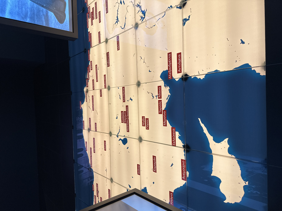
The image displays a large, illuminated wall map, likely part of an indoor exhibition or museum. The map is composed of multiple square panels, creating a grid-like appearance. It depicts the geography of Asia Minor (modern-day Turkey), the Eastern Mediterranean, and the island of Cyprus, with landmasses in a bright, light color and bodies of water in a dark blue. No people are visible, and there is no apparent activity taking place. The scene is static, focusing on the informational display. In the top-left and bottom-right corners, parts of what appear to be display screens or frames are visible. Notable details include numerous red rectangular labels with Greek text, indicating various cities and regions across the depicted area. The map is brightly lit from behind, emphasizing the geographical outlines. Visible text on the map includes several historical and modern city names in Greek: - Άγκυρα (Ankara) - Ικόνιο (Konya) - Σινασός (Sinasos/Mustafapaşa) - Κόραμα (Göreme) - Νεάπολη | Προκόπι (Neapolis/Nevşehir | Prokopion/Urgup) - Νίγδη (Niğde) - Πόρος (Poros) - Καραμάν (Karaman) - Καισάρεια (Kayseri) - Ταρσός (Tarsus) - Άδανα (Adana) - Μερσίνα (Mersin) - Αλάγια (Alanya) - Σελεύκεια (Seleucia/Silifke) - Ανεμούριο (Anamur/Anemurium) - Αλεξανδρέττα (Alexandretta/İskenderun) - Αντιόχεια (Antioch/Antakya) - Μελιτηνή (Melitene/Malatya) - Σεβάστεια (Sebasteia/Sivas) The map highlights cities with significant historical Greek populations, particularly in the context of the Greek presence in Asia Minor and events like the population exchange. The display likely serves an educational or commemorative purpose within the context of Nea Filadelfia, Greece.
No transactions found