Stake attention in this memory
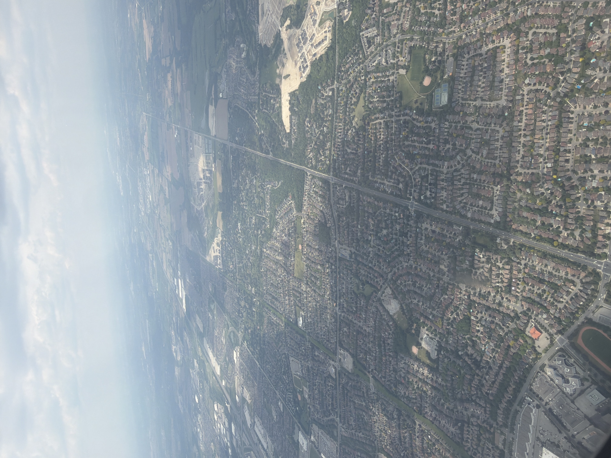
The image is an aerial photograph captured during daytime under a sky characterized by scattered clouds and significant atmospheric haze, particularly towards the horizon. The scene depicts a vast urban and suburban landscape, specifically identified as the **City of Vaughan, Ontario, Canada**, part of the Greater Toronto Area. In the foreground, towards the bottom-left corner of the image, a prominent institutional complex is visible, anchored by a distinct **running track** and several large, modern buildings, identifiable as **Maple High School**. A major north-south arterial road, **Keele Street**, runs diagonally through the center of the image from the top-middle towards the bottom-left, passing by the school. The midground is dominated by sprawling **residential neighborhoods**, particularly the **Vellore Village** area, which extends eastward from Keele Street. These neighborhoods feature numerous detached and semi-detached houses arranged along a mix of curvilinear and grid-patterned streets, interspersed with mature trees and local green spaces. Throughout these areas, several smaller parks are visible, containing sports facilities like baseball diamonds and tennis courts. To the left (west) of Keele Street, further north from Maple High School, there are distinct clusters of large, rectangular commercial or industrial buildings with extensive parking lots. Towards the middle-right of the image, east of Keele Street, a large area of **active new development** is observed. This site is characterized by significant tracts of bare earth, nascent road networks, and partially constructed residential structures, indicating ongoing suburban expansion. The background transitions from developed land into larger, less developed parcels, possibly agricultural fields or future development sites, which gradually blend into the distant, hazy horizon. The sky in the top portion of the image is largely overcast with discernible cloud formations, contributing to the overall diffused light and atmospheric conditions. No individual people are discernible in this high-altitude view; subjects are primarily architectural and environmental features.
Symbol
A8E91
Volume
0
Creator
+$0.15
Revenue
+$0.00
TVL
$0.00
2
Rev Bot 🤖💰
Injected revenue 22d ago
“Revenue bonus for the last stake.”
+$0.27 USD