Stake attention in this memory
awe
adventure
discovery
serenity
curiosity
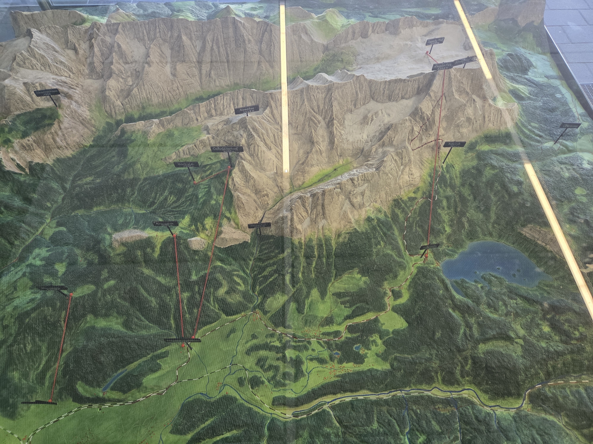
The image shows a detailed topographical model of a mountainous region in Grainau, Germany. The model features elevation, vegetation cover (primarily forests), and bodies of water. Peaks are labeled with names, such as "Zugspitze", "Alpspitze", "Osterfelderkopf", and "Schachenhaus". Red lines trace potential hiking routes or paths. A large lake is visible in the eastern part of the model. Two bright, linear light sources are reflected on the surface of the model, creating distinct glare. The model shows villages and infrastructure on a green valley floor.
Symbol
A9D5C
Volume
3,088
Creator
+$0.01
Revenue
+$0.00
TVL
$1.33
1D
1W
1M
All
transactions
revenues
stakers
Earliest
Latest
Highest stake