
Sign in
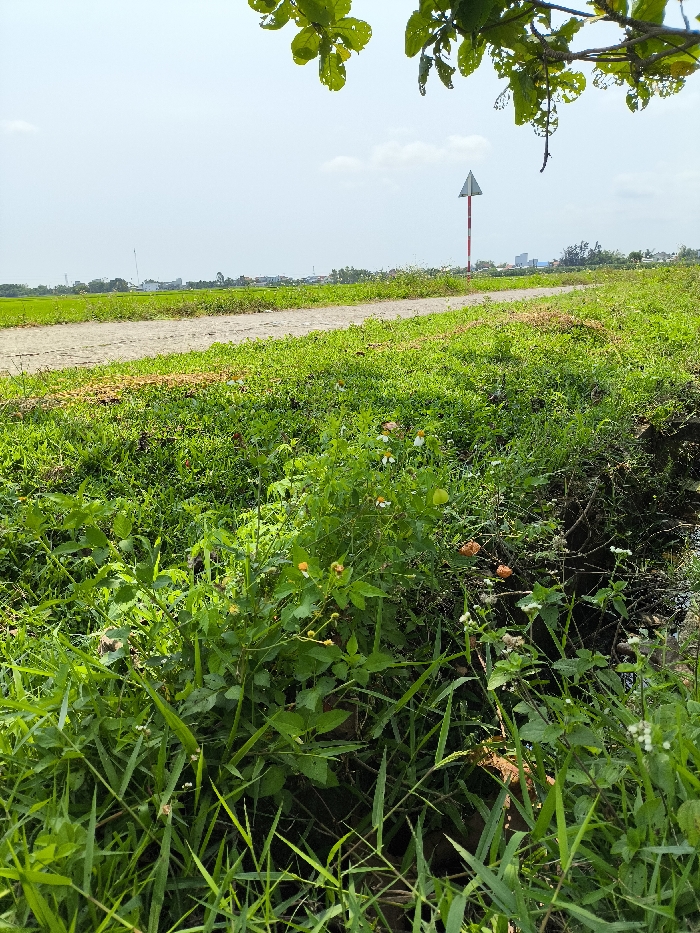
The image captures a semi-rural landscape on the periphery of Đà Nẵng, Vietnam, under a clear, light blue sky with minimal cloud cover.

In the immediate foreground, dense, lush green vegetation, including various grasses and broadleaf plants, dominates the lower half of the frame. Among these plants are small white flowers with yellow centers and other yellowish-orange blossoms. A dark, narrow trench or ditch is partially visible on the bottom right, obscured by vegetation.

A light-colored, unpaved dirt or gravel path traverses the midground, curving from the left-center towards the right. To the left of this path, an expansive, flat green field, indicative of agricultural land (likely rice paddies), extends towards the horizon. To the right of the path, a tall, slender pole stands vertically. This pole features alternating red and white horizontal stripes and is topped with a white triangular sign pointing upwards, resembling a navigational marker.

In the distant background, a low-rise urban skyline with several buildings is visible on the horizon, indicating the proximity of a developed area. The top of the frame is partially obscured by the green leaves of an unseen tree or shrub, some displaying small perforations. No individuals or discernible actions are present in the scene. The environment is characterized by a transition from agricultural land to an urban fringe, likely adjacent to a waterway given the presence of the navigational aid.
Metr@art

Mar 20, 2026, 4:06 AM

Đà Nẵng, Vietnam

Stake attention in this memory

Peaceful
Tranquil
Serene
Refreshing
Calming

The image captures a semi-rural landscape on the periphery of Đà Nẵng, Vietnam, under a clear, light blue sky with minimal cloud cover. In the immediate foreground, dense, lush green vegetation, including various grasses and broadleaf plants, dominates the lower half of the frame. Among these plants are small white flowers with yellow centers and other yellowish-orange blossoms. A dark, narrow trench or ditch is partially visible on the bottom right, obscured by vegetation. A light-colored, unpaved dirt or gravel path traverses the midground, curving from the left-center towards the right. To the left of this path, an expansive, flat green field, indicative of agricultural land (likely rice paddies), extends towards the horizon. To the right of the path, a tall, slender pole stands vertically. This pole features alternating red and white horizontal stripes and is topped with a white triangular sign pointing upwards, resembling a navigational marker. In the distant background, a low-rise urban skyline with several buildings is visible on the horizon, indicating the proximity of a developed area. The top of the frame is partially obscured by the green leaves of an unseen tree or shrub, some displaying small perforations. No individuals or discernible actions are present in the scene. The environment is characterized by a transition from agricultural land to an urban fringe, likely adjacent to a waterway given the presence of the navigational aid.

Loading AttnAds…

transactions
revenues
stakers
Earliest
Latest
Highest stake

No transactions found

More from this user

More from Đà Nẵng

Metr@art

Mar 20, 2026, 4:06 AM

Đà Nẵng, Vietnam

Licensed under Creative Commons Attribution 4.0 International License. You are free to share and adapt this content with proper attribution.