Stake attention in this memory
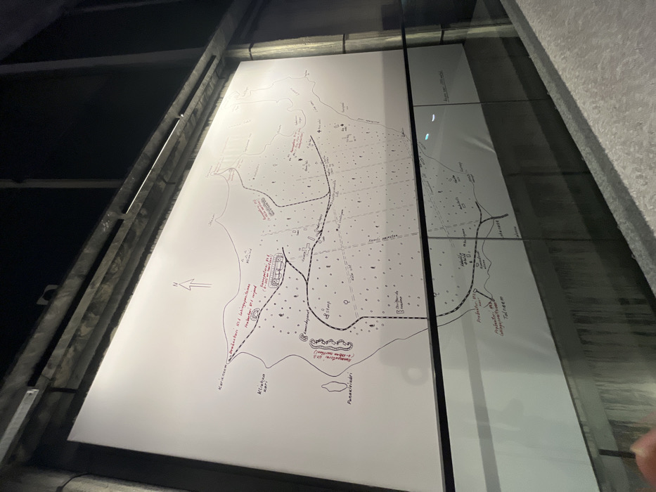
The image displays a large, hand-drawn map presented in a dark, possibly museum or exhibition setting. The map is set on a bright, illuminated white surface, which might be a light table or a backlit panel, with strong reflections on the right side suggesting a glass or transparent barrier. Metal framing is visible on the left and top edges, enclosing the display. The map itself depicts a coastal landscape with a prominent shoreline along the left and bottom. It features various geographical elements, including dotted lines representing paths or roads, solid lines for more significant routes, and small shapes indicating buildings or settlements. Scattered dots across the land suggest vegetation or undeveloped terrain. An arrow indicating North is drawn on the bottom left. Visible handwritten text, in both black and red ink, labels various locations and features. Many names appear to be in Estonian, consistent with the given location context of Tallinn, Estonia. Notable labels on the left and bottom include: "Karirei-nem", "Müüeva küla", and "Punakivi mägi". Near a complex of buildings on the left-center, red text reads: "Suurepõldu 1864 a. kaardil" (meaning "Suurepõldu on the 1864 map") and "Projektiert u. (illegible word) 1944.a." ("Projected in 1944"), with "Sissekäigu asukoht" ("Entrance location") below. Central labels include: "Kadakamägi", "Sõõp", and "Lõugu". Towards the top and right, names like "Ristna nina" ("Ristna cape"), "Kuuseluht", "Agapäe küla", "Lauka", and "Pargimaa" are discernible. On the reflective right panel, partial text includes "Agapae", "Kõrgessaare", and near another building complex, "Projektiert 1944 a." ("Projected 1944") followed by "Võrgukaev ja veejuhtm" ("Net well and water pipe"). "Kassari" and "Tallinamägi" are also visible. The overall impression is a detailed historical or geographical display, likely pertaining to a specific area in Estonia, given the place names and dates indicating historical mapping or planning.
No transactions found