Sign in
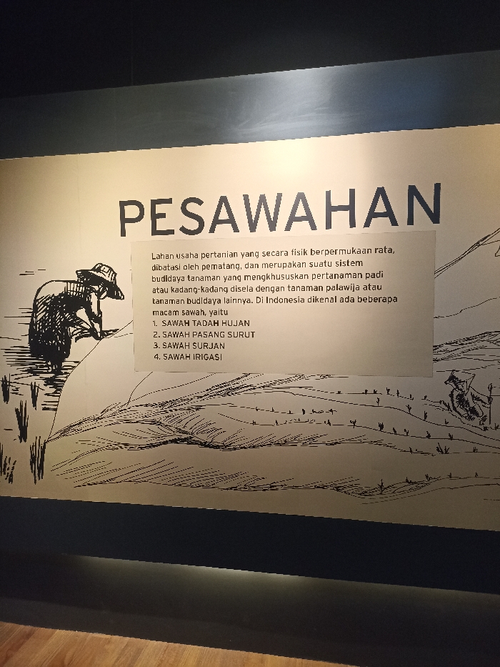
The image shows a black and white illustration on a light grey wall, depicting a rice paddy field in Bogor, Indonesia, at the coordinates -6.599 latitude and 106.794 longitude. The illustration portrays a farmer bending over, likely tending to rice plants, while a field of rice paddies extends from left to right in the background. The text below the image reads "PESAWAHAN", which translates to "rice paddy fields" in English, and explains that rice farming is a flat-surface farming system that utilizes traditional methods. The text also lists several different types of rice paddies found in Indonesia.  The wall is part of an indoor exhibition, and there is a black baseboard and light wooden floor below the wall.  There are no other people or objects visible in the image.
FM-DWNFF3

Apr 9, 2025, 4:01 AM

Bogor, Indonesia

Stake attention in this memory

informative
educational
rustic
agricultural
historical

The image shows a black and white illustration on a light grey wall, depicting a rice paddy field in Bogor, Indonesia, at the coordinates -6.599 latitude and 106.794 longitude. The illustration portrays a farmer bending over, likely tending to rice plants, while a field of rice paddies extends from left to right in the background. The text below the image reads "PESAWAHAN", which translates to "rice paddy fields" in English, and explains that rice farming is a flat-surface farming system that utilizes traditional methods. The text also lists several different types of rice paddies found in Indonesia. The wall is part of an indoor exhibition, and there is a black baseboard and light wooden floor below the wall. There are no other people or objects visible in the image.

Loading AttnAds…

transactions
revenues
stakers
Earliest
Latest
Highest stake

No transactions found

More from this user

More from Bogor

FM-DWNFF3

Apr 9, 2025, 4:01 AM

Bogor, Indonesia

Licensed under Creative Commons Attribution 4.0 International License. You are free to share and adapt this content with proper attribution.