
Sign in
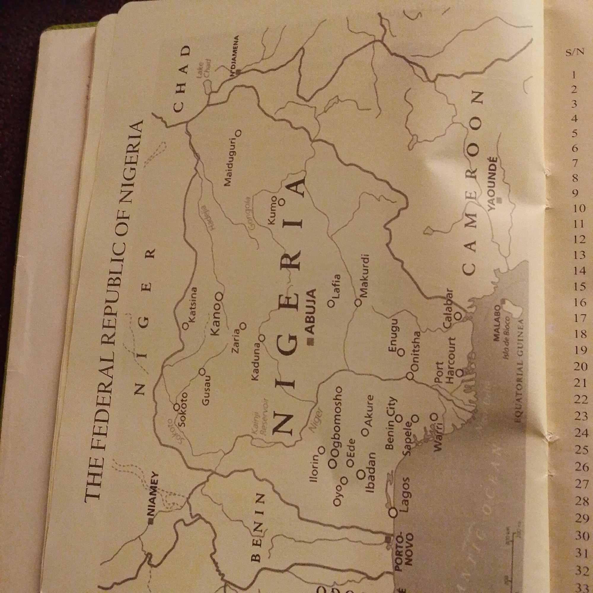
This media file is a close-up, angled photograph of a map showing Nigeria and its surrounding countries. The map is detailed, with national borders, cities, rivers, and geographical features indicated. The text on the map includes country names like "NIGERIA," "CHAD," "CAMEROON," and "BENIN," as well as city names such as "ABUJA," "LAGOS," "KANO," and "NIAMEY." Adjacent to the map, a numbered list from 1 to 33 is visible, likely a serial number or index. The map appears to be part of a book or atlas, as indicated by the binding on the left side and the textured surface it rests upon. The lighting suggests an indoor environment, and the image quality is clear enough to read most of the text. No people or specific events are depicted, the focus is solely on the cartographic representation of the region. The location context "Jalingo, Nigeria" provided is not directly verifiable from the image itself, as Jalingo is not explicitly labeled on this particular map excerpt. However, the map clearly centers on the Federal Republic of Nigeria.
FM-66btC3

Jun 30, 2026, 3:18 PM

Jalingo, Nigeria

Moment

Stake attention in this memory

educational
informative
geographical
historical
navigational

This media file is a close-up, angled photograph of a map showing Nigeria and its surrounding countries. The map is detailed, with national borders, cities, rivers, and geographical features indicated. The text on the map includes country names like "NIGERIA," "CHAD," "CAMEROON," and "BENIN," as well as city names such as "ABUJA," "LAGOS," "KANO," and "NIAMEY." Adjacent to the map, a numbered list from 1 to 33 is visible, likely a serial number or index. The map appears to be part of a book or atlas, as indicated by the binding on the left side and the textured surface it rests upon. The lighting suggests an indoor environment, and the image quality is clear enough to read most of the text. No people or specific events are depicted, the focus is solely on the cartographic representation of the region. The location context "Jalingo, Nigeria" provided is not directly verifiable from the image itself, as Jalingo is not explicitly labeled on this particular map excerpt. However, the map clearly centers on the Federal Republic of Nigeria.

Symbol

ADD1E

Volume

3,770

Creator

+$0.00

Revenue

+$0.01

TVL

$0.32

1D
1W
1M
All

Loading AttnAds…

transactions
revenues
stakers
Earliest
Latest
Highest stake

1

FM-r1gUH2

Staked 1mo ago

$0.32 USD

+$0.00 USD

+1%

2

Rev Bot 🤖💰

Injected revenue 1mo ago

Revenue bonus for the last stake.

+$0.01 USD

More from this user

More from Jalingo

FM-66btC3

Jun 30, 2026, 3:18 PM

Jalingo, Nigeria

Licensed under Creative Commons Attribution 4.0 International License. You are free to share and adapt this content with proper attribution.