Stake attention in this memory
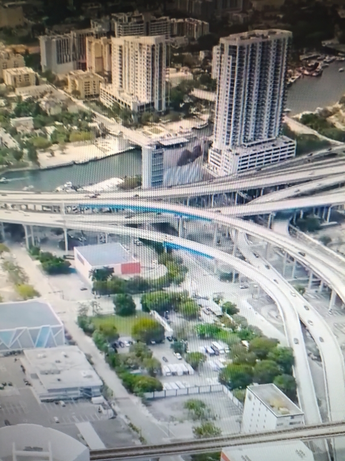
The image is an aerial view of the city of Netanya, Israel. It is taken from a drone, looking down at the city from a significant height. The image is centered on a large, complex highway interchange with multiple bridges and ramps. The highway is very busy, with many cars and trucks driving on it. The city is in the foreground, with a large number of buildings, including high-rise apartment buildings, smaller residential buildings, and commercial buildings. The image features an interweaving network of multi-level highway ramps and bridges connecting to a nearby canal. There are several vehicles driving along the highway. The highway is surrounded by trees and vegetation, which is prevalent throughout the image. There is a large green area with several buildings, some with flat roofs, that is adjacent to the interchange, and a body of water to the left of the highway interchange. The buildings in the image are a mix of residential and commercial structures, and the overall scene is one of urban development and traffic flow.
No transactions found
More from this user
More from Netanya