
Sign in
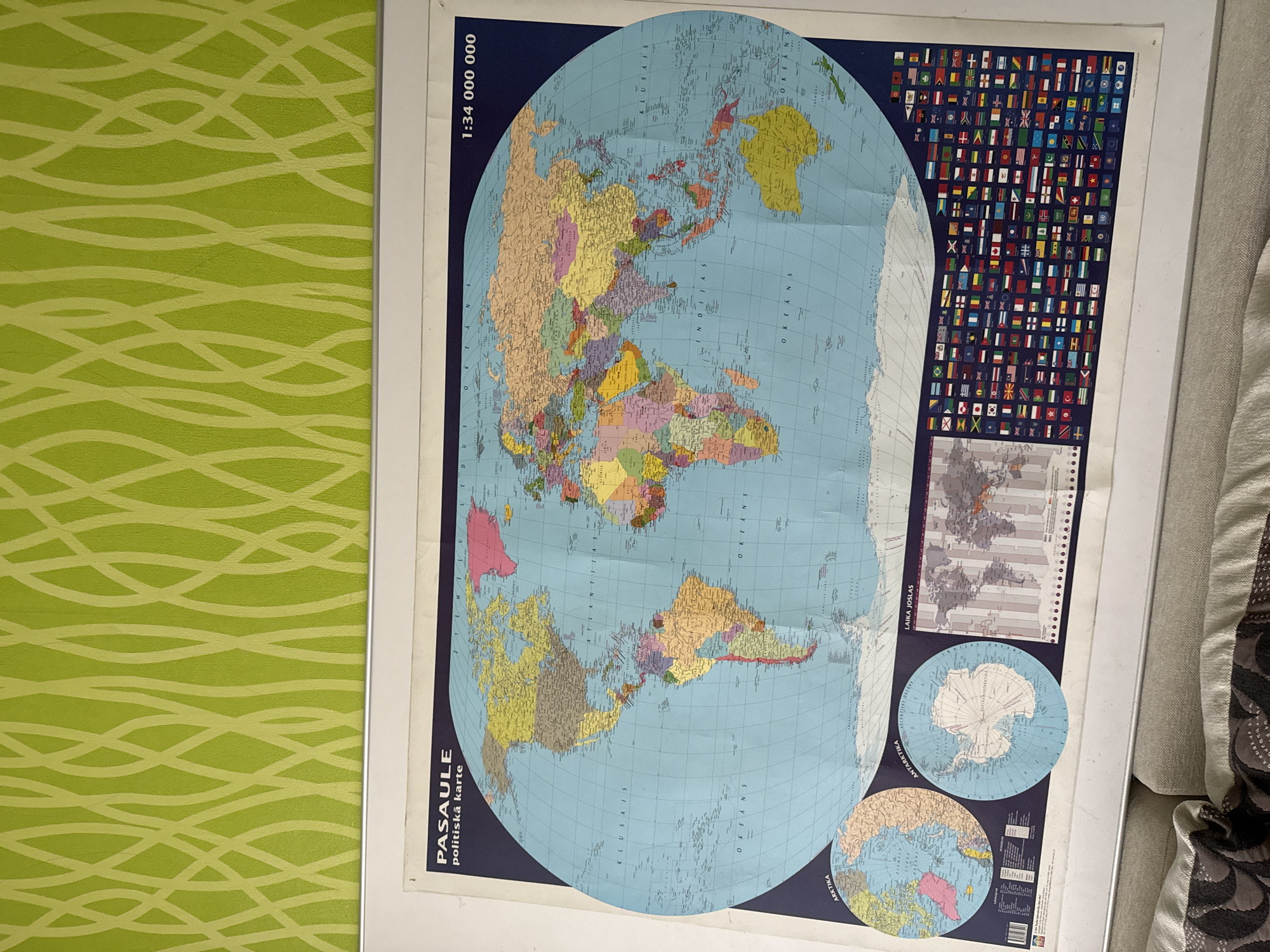
This media file is a photograph of a large political world map displayed on a wall, likely in a home or educational setting in Riga, Latvia. The map is the primary subject, dominating the frame. It is a detailed, colorful representation of the Earth's continents and countries, with the "PASALE politiskā karte" text in Latvian, translating to "WORLD political map," printed along the bottom left. Above this, the scale "1:34 000 000" is clearly visible.

The map features several inset diagrams: one illustrating time zones ("LAIKA JOSLAS"), and two circular insets, one depicting Antarctica ("ANTARKTIKA") and the other the Arctic ("ARKTIKA"). To the right of the main world map, there is a grid of national flags. The map is slightly creased, indicating it is a physical, possibly a bit old, wall map.

The background to the left of the map shows a lime green wall with a repeating abstract pattern of thin, pale yellow curved lines. To the right of the map, a portion of a beige upholstered surface, possibly a sofa or chair, is visible, with a patterned cushion. The lighting appears to be ambient, suggesting an indoor setting during the daytime. No people are visible in the image. The overall impression is one of an educational or decorative map display.
ivcccis

Jun 28, 2026, 5:03 PM

Riga, Latvia

Moment

Stake attention in this memory

curiosity
wonder
educational
geographical
informative

This media file is a photograph of a large political world map displayed on a wall, likely in a home or educational setting in Riga, Latvia. The map is the primary subject, dominating the frame. It is a detailed, colorful representation of the Earth's continents and countries, with the "PASALE politiskā karte" text in Latvian, translating to "WORLD political map," printed along the bottom left. Above this, the scale "1:34 000 000" is clearly visible. The map features several inset diagrams: one illustrating time zones ("LAIKA JOSLAS"), and two circular insets, one depicting Antarctica ("ANTARKTIKA") and the other the Arctic ("ARKTIKA"). To the right of the main world map, there is a grid of national flags. The map is slightly creased, indicating it is a physical, possibly a bit old, wall map. The background to the left of the map shows a lime green wall with a repeating abstract pattern of thin, pale yellow curved lines. To the right of the map, a portion of a beige upholstered surface, possibly a sofa or chair, is visible, with a patterned cushion. The lighting appears to be ambient, suggesting an indoor setting during the daytime. No people are visible in the image. The overall impression is one of an educational or decorative map display.

Symbol

B0581

Volume

0

Creator

+$0.03

Revenue

+$0.00

TVL

$0.00

1D
1W
1M
All

Loading AttnAds…

transactions
revenues
stakers
Earliest
Latest
Highest stake

1

FM-jDTUB3

Staked 1mo ago
Redeemed 1mo ago

$2.67 USD

+$0.02 USD

Fee: $0.01 (0.25%)

+0.8%

2

ivcccis

Staked 1mo ago
Redeemed 1mo ago

$0.27 USD

-$0.00 USD

Fee: $0.01 (2.5%)

-1%

3

Rev Bot 🤖💰

Injected revenue 1mo ago

Revenue bonus for the last stake.

+$0.06 USD

More from this user

More from Riga

ivcccis

Jun 28, 2026, 5:03 PM

Riga, Latvia

Licensed under Creative Commons Attribution 4.0 International License. You are free to share and adapt this content with proper attribution.