
Sign in
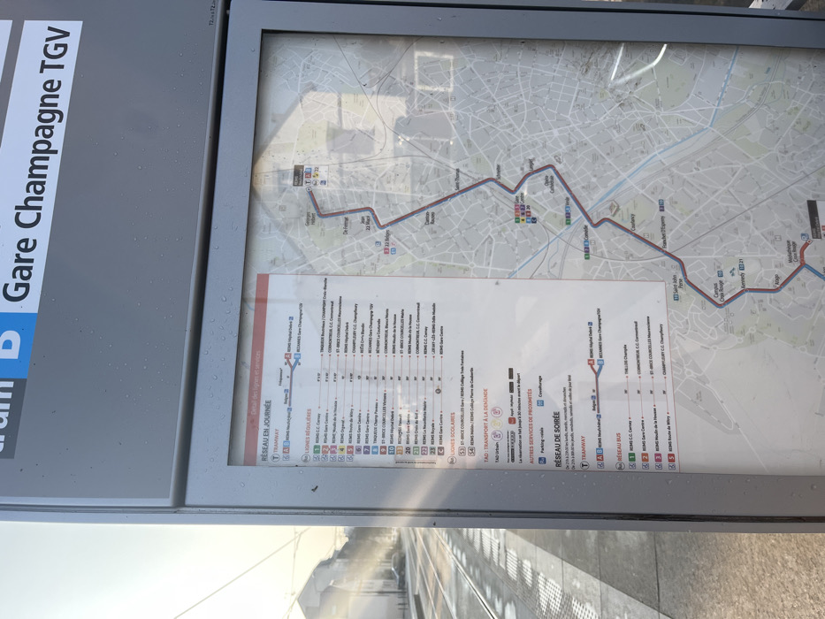
A sign at the Gare Champagne TGV station in Reims, France, at coordinates (49.274, 4.018), displays a map of the city's public transportation routes. The sign is made of silver metal with a white surface. The map is oriented with north to the top and shows a blue and red line running from Reims Hospital to Gare Champagne TGV, with numbered stops along the route. The sign also has a list of bus routes and times in French. The map is surrounded by a black border. In the background, a blurred image of a tram track and street can be seen.  The sign is partially obscured by a bright glare of sunlight.  The sign is located in an urban environment.
FM-kkr2I2

Mar 14, 2025, 7:50 AM

Reims, France

Stake attention in this memory

informative
organized
helpful
practical
navigational

A sign at the Gare Champagne TGV station in Reims, France, at coordinates (49.274, 4.018), displays a map of the city's public transportation routes. The sign is made of silver metal with a white surface. The map is oriented with north to the top and shows a blue and red line running from Reims Hospital to Gare Champagne TGV, with numbered stops along the route. The sign also has a list of bus routes and times in French. The map is surrounded by a black border. In the background, a blurred image of a tram track and street can be seen. The sign is partially obscured by a bright glare of sunlight. The sign is located in an urban environment.

Loading AttnAds…

transactions
revenues
stakers
Earliest
Latest
Highest stake

No transactions found
More from this user

More from Reims

FM-kkr2I2

Mar 14, 2025, 7:50 AM

Reims, France

Licensed under Creative Commons Attribution 4.0 International License. You are free to share and adapt this content with proper attribution.