Stake attention in this memory
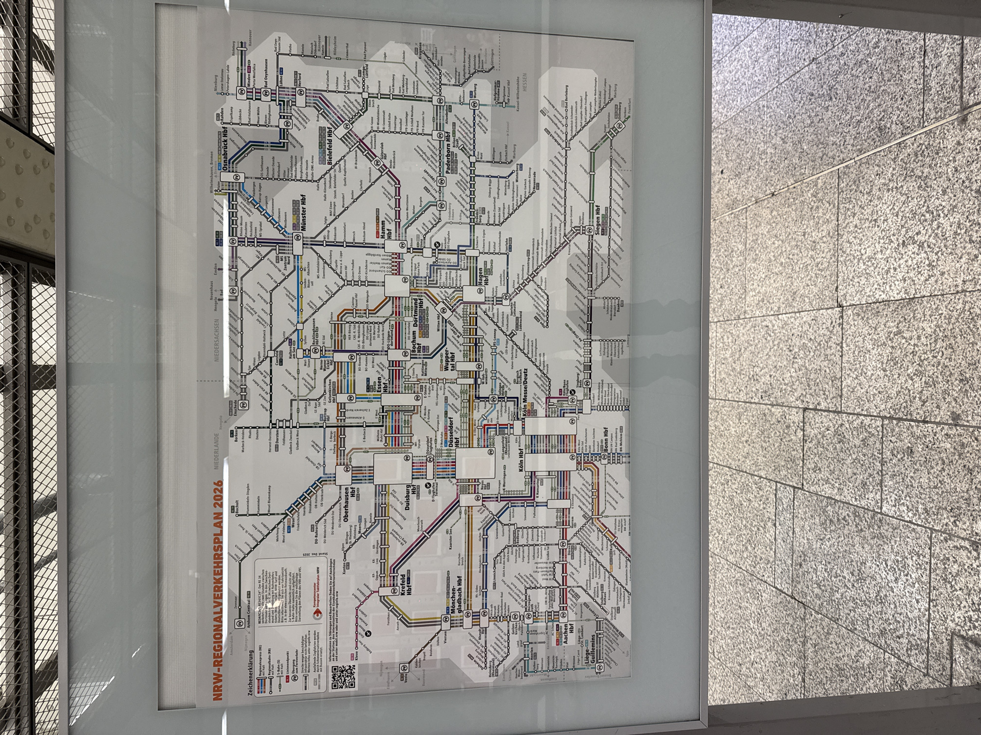
The image shows a framed regional transport map for NRW (North Rhine-Westphalia) in Germany, dated 2026. The map displays various train lines and stations across the region, with major hubs like Düsseldorf, Dortmund, Essen, Duisburg, and Cologne clearly marked. The map also indicates connections to neighboring countries like the Netherlands. The framing is simple, with a white border, and the map is mounted on a wall above a patterned floor made of grey granite tiles. The environment appears to be an indoor public space, possibly a train station, given the presence of the transport map and the tiled flooring. There are no people visible in the image. The camera is positioned to capture the map and the floor in the foreground, with the top edge of the frame showing a patterned ceiling or structure.
Symbol
B075F
Volume
4,999
Creator
+$0.00
Revenue
+$0.00
TVL
$2.44