
Sign in
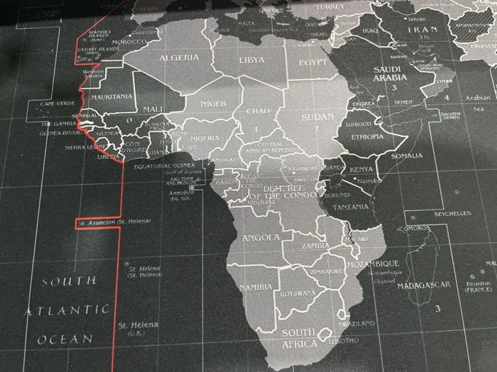
The image is a close-up photograph of a grayscale world map, predominantly displaying the continent of Africa, portions of Europe (Portugal, Spain), the Middle East (Turkey, Syria, Iraq, Iran, Saudi Arabia, Yemen, Oman), and the South Atlantic Ocean. The map includes the country of South Africa, with Durban being a city within this country; however, the image itself is not a scene or location *in* Durban, but rather a depiction *of* a map that includes South Africa.

Countries are rendered in varying shades of gray, with oceans appearing black. Country names and major cities (e.g., Nairobi, Tehran) are labeled in white text. A prominent red line traces the western coast of Africa, extending from the vicinity of Morocco, down past Senegal and Liberia, into the South Atlantic Ocean, where it connects to labeled points such as "Asuncion (St. Helena)" and "St. Helena (U.K.)". This red line likely represents a geographical boundary or a specific route. Faint grid lines, indicative of latitude and longitude, are visible across the map. Numerical labels (e.g., "2", "3", "4") are present in various regions, suggesting time zone demarcations. No people, living subjects, or direct actions or interactions are depicted within the map's content or the photograph itself. The environment is limited to the flat surface of the map, suggesting an indoor setting where such a map would be displayed or stored.
AnthonyJoshua

Mar 5, 2026, 9:37 AM

Durban, South Africa

Stake attention in this memory

Geographic
Informative
Contemplative
Neutral
Objective

The image is a close-up photograph of a grayscale world map, predominantly displaying the continent of Africa, portions of Europe (Portugal, Spain), the Middle East (Turkey, Syria, Iraq, Iran, Saudi Arabia, Yemen, Oman), and the South Atlantic Ocean. The map includes the country of South Africa, with Durban being a city within this country; however, the image itself is not a scene or location *in* Durban, but rather a depiction *of* a map that includes South Africa. Countries are rendered in varying shades of gray, with oceans appearing black. Country names and major cities (e.g., Nairobi, Tehran) are labeled in white text. A prominent red line traces the western coast of Africa, extending from the vicinity of Morocco, down past Senegal and Liberia, into the South Atlantic Ocean, where it connects to labeled points such as "Asuncion (St. Helena)" and "St. Helena (U.K.)". This red line likely represents a geographical boundary or a specific route. Faint grid lines, indicative of latitude and longitude, are visible across the map. Numerical labels (e.g., "2", "3", "4") are present in various regions, suggesting time zone demarcations. No people, living subjects, or direct actions or interactions are depicted within the map's content or the photograph itself. The environment is limited to the flat surface of the map, suggesting an indoor setting where such a map would be displayed or stored.

Loading AttnAds…

transactions
revenues
stakers
Earliest
Latest
Highest stake

No transactions found

More from this user

More from Durban

AnthonyJoshua

Mar 5, 2026, 9:37 AM

Durban, South Africa

Licensed under Creative Commons Attribution 4.0 International License. You are free to share and adapt this content with proper attribution.