Sign in
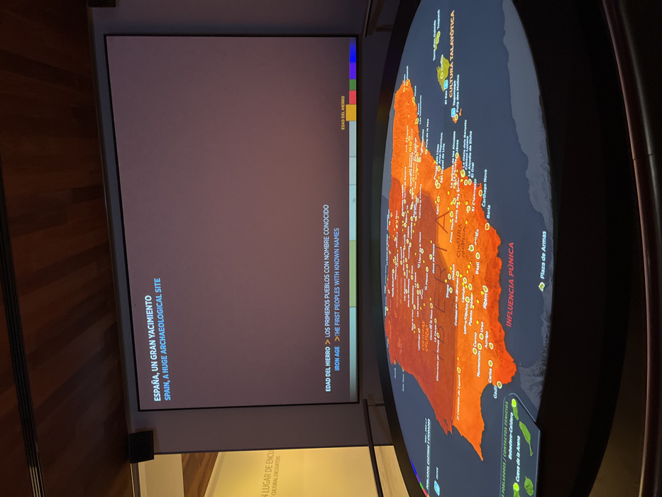
The image shows a circular, interactive map of the Iberian Peninsula, located in the Museo Nacional de Antropología, Madrid, Spain (latitude: 40.423, longitude: -3.689). The map is projected onto a large, circular table with a dark, polished wooden surface. It depicts various archaeological sites and regions in Spain during the Iron Age, with the text "Iron Age - The First Peoples with Known Names" highlighted in blue below the map. The map is displayed on a digital platform with the words "ESPAÑA, UN GRAN YACIMIENTO" and "SPAIN, A HUGE ARCHAEOLOGICAL SITE" at the top, and features detailed labels and illustrations. The map's orange and red tones, as well as the placement of labeled points, showcase the various cultural influences that shaped the region during that era.
FM-lnhCZ2

Apr 12, 2025, 1:35 PM

Madrid, Spain

Stake attention in this memory

historical
educational
informative
interactive
intriguing

The image shows a circular, interactive map of the Iberian Peninsula, located in the Museo Nacional de Antropología, Madrid, Spain (latitude: 40.423, longitude: -3.689). The map is projected onto a large, circular table with a dark, polished wooden surface. It depicts various archaeological sites and regions in Spain during the Iron Age, with the text "Iron Age - The First Peoples with Known Names" highlighted in blue below the map. The map is displayed on a digital platform with the words "ESPAÑA, UN GRAN YACIMIENTO" and "SPAIN, A HUGE ARCHAEOLOGICAL SITE" at the top, and features detailed labels and illustrations. The map's orange and red tones, as well as the placement of labeled points, showcase the various cultural influences that shaped the region during that era.

Loading AttnAds…

transactions
revenues
stakers
Earliest
Latest
Highest stake

No transactions found

More from this user

More from Madrid

FM-lnhCZ2

Apr 12, 2025, 1:35 PM

Madrid, Spain

Licensed under Creative Commons Attribution 4.0 International License. You are free to share and adapt this content with proper attribution.