
Sign in
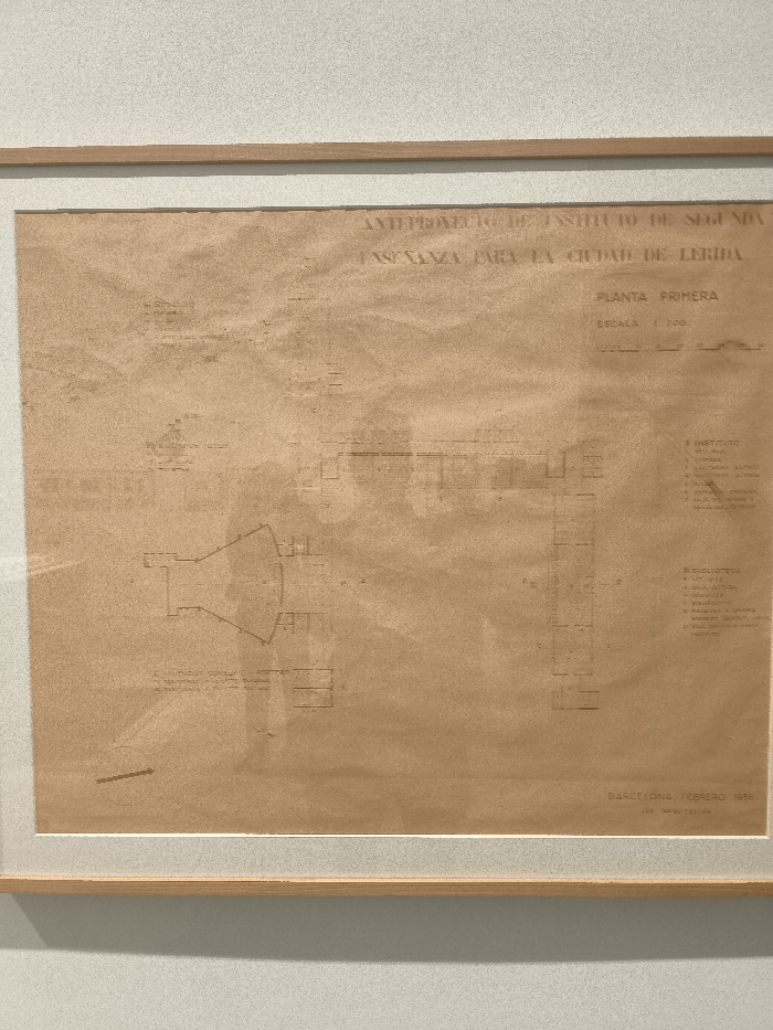
The image shows a framed blueprint of a building located at 40.398 latitude, -3.654 longitude in Madrid, Spain. The blueprint is titled "AMPLIACION DEL INSTITUTO DE SEGUNDA ENSEÑANZA PARA LA CIUDAD DE LERIDA." The blueprint has the words "PLANTA PRIMERA," "ESCALA 1:200," "INSTITUTO," and "BIBLIOTECA" printed on it. The bottom right corner of the blueprint says, "BARCELONA, FEBRERO 1956." The blueprint is printed on a tan piece of paper. The paper appears to be worn and faded in spots. The blueprint is framed in a light brown wood frame. The image is slightly out of focus.
FM-DtDaN2

Apr 20, 2025, 11:39 AM

Madrid, Spain

Stake attention in this memory

architectural
technical
historical
vintage
academic

The image shows a framed blueprint of a building located at 40.398 latitude, -3.654 longitude in Madrid, Spain. The blueprint is titled "AMPLIACION DEL INSTITUTO DE SEGUNDA ENSEÑANZA PARA LA CIUDAD DE LERIDA." The blueprint has the words "PLANTA PRIMERA," "ESCALA 1:200," "INSTITUTO," and "BIBLIOTECA" printed on it. The bottom right corner of the blueprint says, "BARCELONA, FEBRERO 1956." The blueprint is printed on a tan piece of paper. The paper appears to be worn and faded in spots. The blueprint is framed in a light brown wood frame. The image is slightly out of focus.

Loading AttnAds…

transactions
revenues
stakers
Earliest
Latest
Highest stake

No transactions found
More from this user

More from Madrid

FM-DtDaN2

Apr 20, 2025, 11:39 AM

Madrid, Spain

Licensed under Creative Commons Attribution 4.0 International License. You are free to share and adapt this content with proper attribution.