
Stake attention in this memory
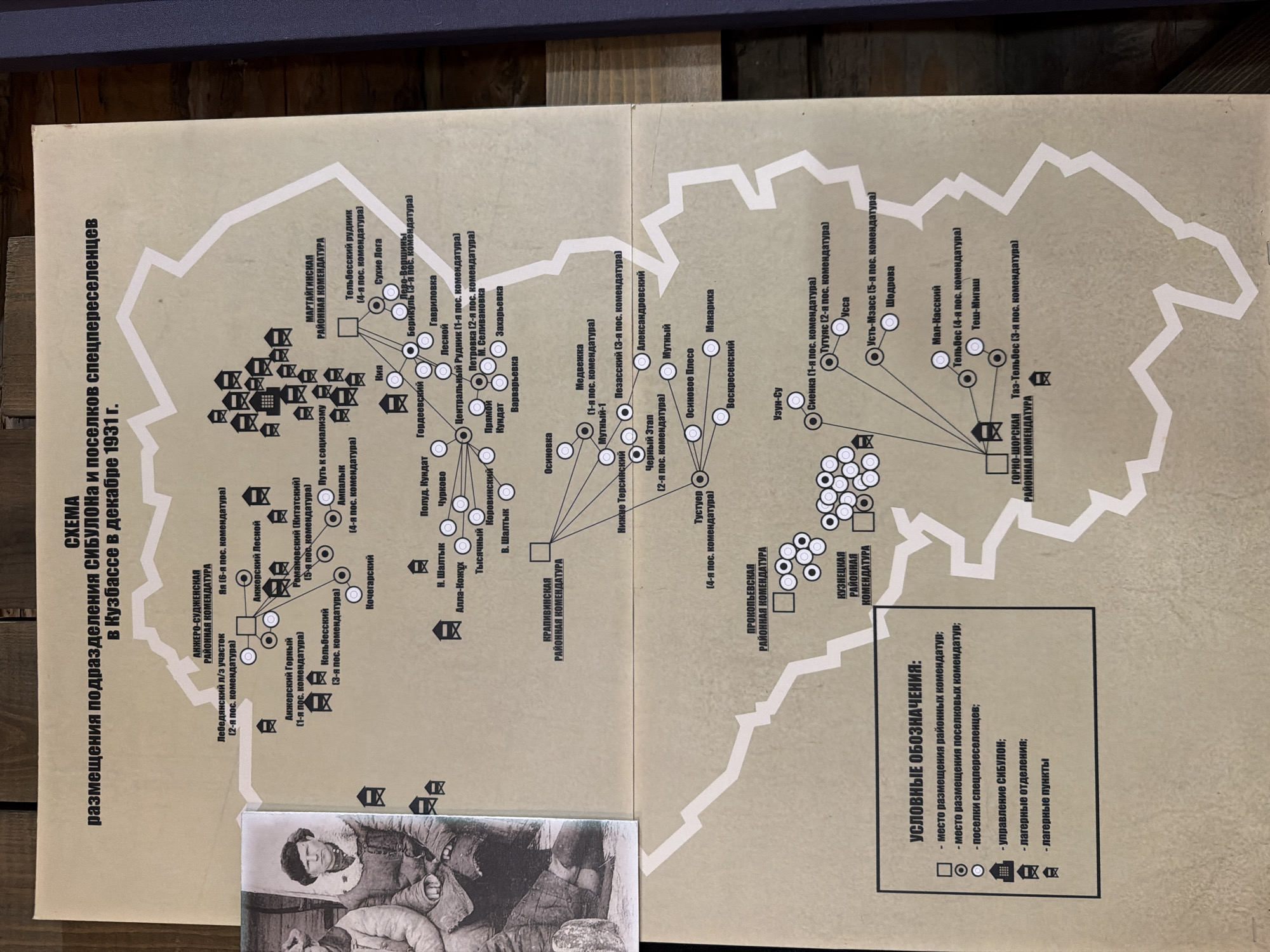
The image displays a schematic map titled "SKEMA razmeshcheniya podrazdeleniya SIBULONA i poselkov spetspereeselets v Kuzbasse v dekabre 1931 g." (Scheme of deployment of SIBULON units and settlements of special settlers in the Kuzbass in December 1931). The map illustrates various locations, likely settlements or work camps, connected by lines and marked with different symbols. These symbols are explained in a legend box on the bottom left, indicating: "mesto razmeshcheniya rayonnykh komendatur" (location of district commandant's offices), "mesto razmeshcheniya poselkovykh komendatur" (location of settlement commandant's offices), "poselki spetspereeselets" (settlements of special settlers), "upravleniye SIBULON" (SIBULON administration), "lagernyye otdeleniya" (camp departments), and "lagernyye punkty" (camp points). Several district commandant's offices are labeled, including Anzhero-Sudzhenskaya, Mariinskaya, Krasnoyarskaya, Prokopyevskaya, and Kuznetskaya. Numerous settlements are also identified by name and number of commandant's office, such as Nyakhomovaya, Putevaya, Tyazhelaya, and Sharypopovo. The map uses circles for settlements and squares for commandant's offices, with smaller circles within larger ones possibly indicating sub-divisions. The lines suggest logistical or administrative connections. The overall context is related to the administrative and settlement structure of SIBULON (likely a Soviet agency involved in resettlement or labor camps) in the Kuzbass region of Russia in 1931. The city of Ust'-Pyzas is not explicitly mentioned on the map, but the map covers a region within the broader Kuzbass area.
Loading AttnAds…
No transactions found