Stake attention in this memory
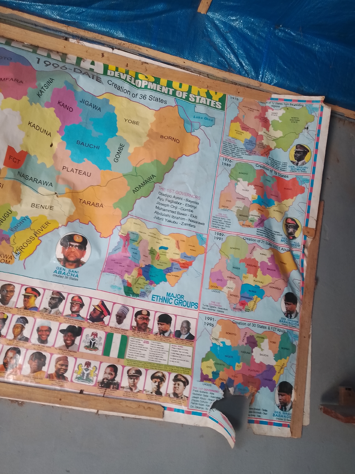
The image shows a colorful wall map of Nigeria detailing the creation of states over time. The map is mounted on a wooden structure and appears to be in a state of disrepair, with some tearing and creasing. Various sections of the map illustrate different periods, such as "1976-1989 Creation of 19 States," "1989-1991 Creation of 21 States & FCT Abuja," and "1991-1996 Creation of 30 States & FCT Abuja." The map includes portraits of military leaders and governors associated with these periods. For example, "GEN. SANI ABACHA Created 36 States" is labeled, and his portrait is visible. Another section shows "GEN. YAKUBU GOWON" with the title "Creation of 12 States from the existing regions." Also visible is "GEN. IBRAHIM BABANGIDA." Below the map, a section labeled "MAJOR ETHNIC GROUPS" displays multiple portraits of individuals. A Nigerian flag and the national emblem are also present. The overall environment suggests an indoor setting, possibly a classroom or an office, with wooden beams and a blue tarp visible in the background. The lighting is somewhat dim, indicating an overcast day or indoor lighting. The request to provide the location in the city of Jalingo, Nigeria, cannot be fulfilled. There is no visual information in the image that specifically identifies the location as Jalingo or anywhere else in Nigeria.
No transactions found