
Sign in
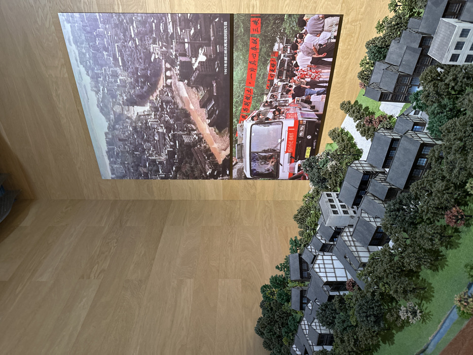
The image depicts a model of a city in Chongqing, China, located at latitude 29.574, longitude 106.589. The model features small buildings with black roofs and white walls, surrounded by green trees and a small stream. In the background, there are two pictures. The top picture is an aerial photograph of the city in 1961, showing a densely populated urban area with a river flowing through it. The bottom picture shows a bus filled with people, with red banners on its side, and a crowd of people standing around it. The scene is set in a museum or exhibition space with wooden walls.
Dickson🇹🇿🇨🇳

May 5, 2025, 8:23 AM

Chongqing, China

Stake attention in this memory

historical
nostalgic
urban
developmental
contrasting

The image depicts a model of a city in Chongqing, China, located at latitude 29.574, longitude 106.589. The model features small buildings with black roofs and white walls, surrounded by green trees and a small stream. In the background, there are two pictures. The top picture is an aerial photograph of the city in 1961, showing a densely populated urban area with a river flowing through it. The bottom picture shows a bus filled with people, with red banners on its side, and a crowd of people standing around it. The scene is set in a museum or exhibition space with wooden walls.

Loading AttnAds…

transactions
revenues
stakers
Earliest
Latest
Highest stake

No transactions found
More from this user

More from Chongqing

Dickson🇹🇿🇨🇳

May 5, 2025, 8:23 AM

Chongqing, China

Licensed under Creative Commons Attribution 4.0 International License. You are free to share and adapt this content with proper attribution.