Sign in
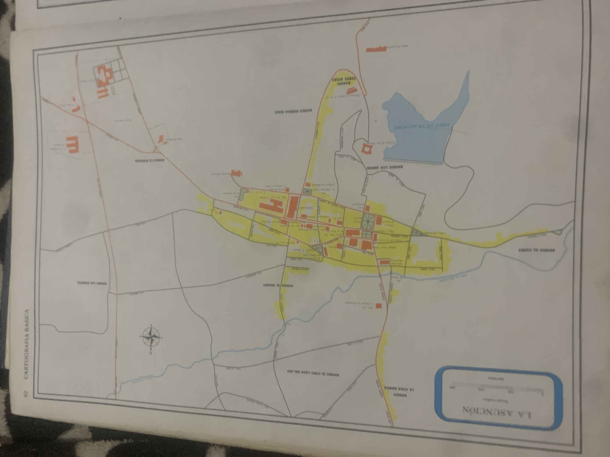
This is a map of La Asunción, Venezuela, likely a section from a larger atlas or topographical document, indicated by "CARTOGRAFIA BASICA" and the page number "92". The map details various neighborhoods, roads, and geographical features within the city and its surroundings.

The central area of the map is densely populated with buildings depicted as red squares and rectangles, suggesting an urban core. Several named neighborhoods are labeled in Spanish, including "BARRIO LA PORTADA," "BARRIO BUENOS AIRES," "BARRIO VERDE BOJAS," "BARRIO LOS ANDES," "BARRIO EL MANEY," and "BARRIO EL COPEY." These are connected by a network of roads, some marked in red and others in gray.

A prominent feature is "DIQUE DE LA ASUNCIÓN," a blue-colored area representing a dam or reservoir, to the northeast of the city center. A river, likely "RIO EL COPEY," flows through the southern part of the mapped area, with "BARRIO EL COPEY" located along its banks. Another labeled area, "BARRIO EL OTRO LADO DEL RIO," indicates a settlement on the opposite side of a river.

There are no people or specific activities depicted, as it is a static map. The time of day and weather are not discernible. The map includes a compass rose to indicate direction. At the bottom right, a scale bar is presented with "LA ASUNCIÓN" prominently displayed within a blue border, acting as the title of this section. The map appears to be in good condition, though the image quality is slightly degraded, suggesting it may be a scan or photograph of the original document.
bombolico

Jun 25, 2026, 2:33 PM

La Tagua, Venezuela

Stake attention in this memory

curious
informative
detailed
educational
analytical

This is a map of La Asunción, Venezuela, likely a section from a larger atlas or topographical document, indicated by "CARTOGRAFIA BASICA" and the page number "92". The map details various neighborhoods, roads, and geographical features within the city and its surroundings. The central area of the map is densely populated with buildings depicted as red squares and rectangles, suggesting an urban core. Several named neighborhoods are labeled in Spanish, including "BARRIO LA PORTADA," "BARRIO BUENOS AIRES," "BARRIO VERDE BOJAS," "BARRIO LOS ANDES," "BARRIO EL MANEY," and "BARRIO EL COPEY." These are connected by a network of roads, some marked in red and others in gray. A prominent feature is "DIQUE DE LA ASUNCIÓN," a blue-colored area representing a dam or reservoir, to the northeast of the city center. A river, likely "RIO EL COPEY," flows through the southern part of the mapped area, with "BARRIO EL COPEY" located along its banks. Another labeled area, "BARRIO EL OTRO LADO DEL RIO," indicates a settlement on the opposite side of a river. There are no people or specific activities depicted, as it is a static map. The time of day and weather are not discernible. The map includes a compass rose to indicate direction. At the bottom right, a scale bar is presented with "LA ASUNCIÓN" prominently displayed within a blue border, acting as the title of this section. The map appears to be in good condition, though the image quality is slightly degraded, suggesting it may be a scan or photograph of the original document.

Loading AttnAds…

transactions
revenues
stakers
Earliest
Latest
Highest stake

No transactions found

More from this user

More from La Tagua

bombolico

Jun 25, 2026, 2:33 PM

La Tagua, Venezuela

Licensed under Creative Commons Attribution 4.0 International License. You are free to share and adapt this content with proper attribution.



