Stake attention in this memory
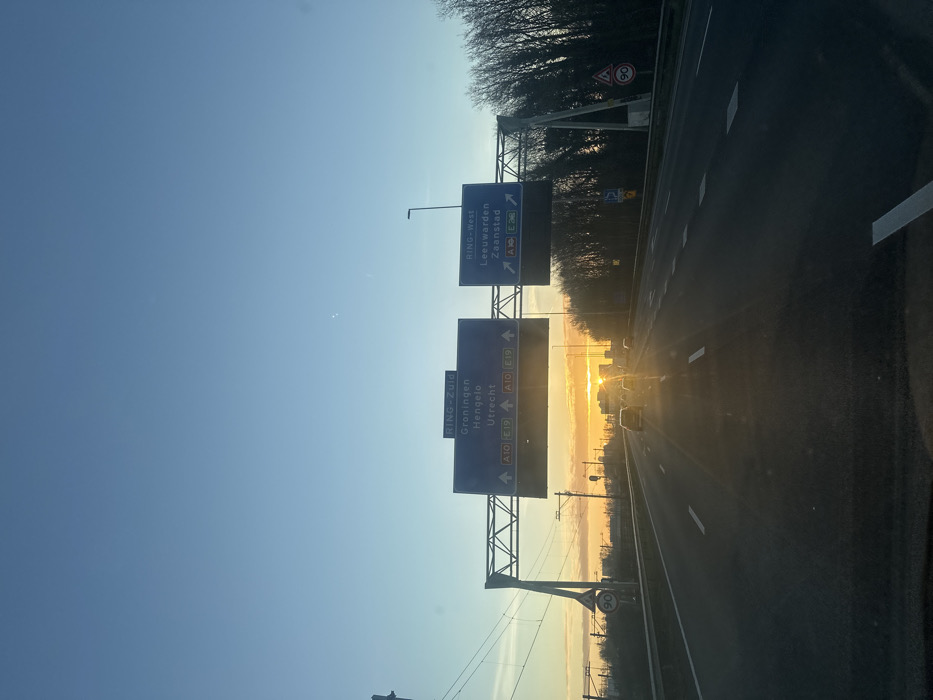
The image depicts a multi-lane highway on the A10 ring road in Amsterdam, Netherlands, during either sunrise or sunset. The perspective is from inside a vehicle traveling forward. The sky is clear blue overhead, transitioning to a bright orange-yellow glow at the horizon, where the sun is visible as an intense, low-lying light source. The sun, partially obscured by distant low-rise structures, causes significant glare and lens flare, illuminating the road ahead. The highway consists of at least three visible lanes marked with white dashed lines on an asphalt surface. Several passenger vehicles are observed in the distance, traveling in the same direction, appearing as dark silhouettes against the bright sunlight. Two prominent blue overhead gantry signs span the highway. The left sign displays "RING-Zuid," directing traffic to "Groningen," "Hengelo," and "Utrecht" via "A10 E19," indicated by three forward-pointing arrows. The right sign displays "RING-West," directing traffic to "Leeuwarden," "Zaandam," and "Zaandstad" via "A10 E35," "A8 E35," and "A7 E35," also indicated by three forward-pointing arrows. On the left side of the highway, parallel to the road, a metal gantry structure with overhead lines suggests the presence of railway tracks. A circular white speed limit sign displaying "90" km/h is mounted on a pole on this side. The right side of the highway features a dense treeline composed of bare-branched trees. A streetlight pole, a second circular "90" km/h speed limit sign, a triangular warning sign with a bicycle symbol, and a blue square 'P' parking sign are visible on the right verge.
No transactions found