
Sign in
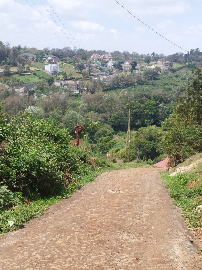
The image depicts a downward-sloping, unpaved dirt path in Nyeri, Kenya, leading into a valley with residential development on the distant hillsides.

In the foreground, a reddish-brown dirt path, approximately 3-4 meters wide, shows an uneven, textured surface indicative of erosion. Patches of green grass and dense green foliage line both sides of the path. On the left, dense green bushes obscure much of the immediate surroundings, with a tall, reddish-brown, seemingly bare tree trunk visible further down the slope behind them. On the right, sparser green vegetation flanks the path. Scattered light-colored debris is present on the path surface in the mid-foreground.

The path descends into a heavily vegetated midground valley. A light brown wooden utility pole, featuring two white markers or insulators, stands upright on the right side of this valley, below the path level. Multiple power lines extend horizontally across the upper portion of the frame, originating from or passing through this area. A section of a red-tiled roof is partially visible through the dense green trees on the lower right side of the valley.

In the background, beyond the valley, multiple hillsides rise, populated with various residential structures. These include large, multi-story homes with light-colored facades and dark roofs, interspersed with numerous green trees and landscaped areas. Some structures appear to be incomplete, showing exposed concrete frames. The hillsides are covered in a mix of manicured greenery and denser tree cover. The sky above is partly cloudy, with scattered white cumulus clouds visible. No individuals are present, and no specific actions or interactions are observed.
Kanjes

Nov 11, 2025, 9:22 AM

Nyeri, Kenya

Stake attention in this memory

Serenity
Nature
Peacefulness
Exploration
Tranquility

The image depicts a downward-sloping, unpaved dirt path in Nyeri, Kenya, leading into a valley with residential development on the distant hillsides. In the foreground, a reddish-brown dirt path, approximately 3-4 meters wide, shows an uneven, textured surface indicative of erosion. Patches of green grass and dense green foliage line both sides of the path. On the left, dense green bushes obscure much of the immediate surroundings, with a tall, reddish-brown, seemingly bare tree trunk visible further down the slope behind them. On the right, sparser green vegetation flanks the path. Scattered light-colored debris is present on the path surface in the mid-foreground. The path descends into a heavily vegetated midground valley. A light brown wooden utility pole, featuring two white markers or insulators, stands upright on the right side of this valley, below the path level. Multiple power lines extend horizontally across the upper portion of the frame, originating from or passing through this area. A section of a red-tiled roof is partially visible through the dense green trees on the lower right side of the valley. In the background, beyond the valley, multiple hillsides rise, populated with various residential structures. These include large, multi-story homes with light-colored facades and dark roofs, interspersed with numerous green trees and landscaped areas. Some structures appear to be incomplete, showing exposed concrete frames. The hillsides are covered in a mix of manicured greenery and denser tree cover. The sky above is partly cloudy, with scattered white cumulus clouds visible. No individuals are present, and no specific actions or interactions are observed.

Loading AttnAds…

transactions
revenues
stakers
Earliest
Latest
Highest stake

No transactions found

More from this user

More from Nyeri

Kanjes

Nov 11, 2025, 9:22 AM

Nyeri, Kenya

Licensed under Creative Commons Attribution 4.0 International License. You are free to share and adapt this content with proper attribution.