Stake attention in this memory
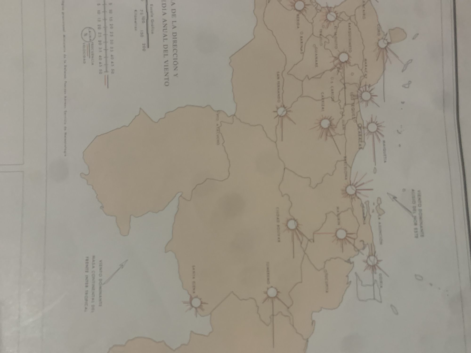
This media file is a scanned image of a map, likely a climatological chart, depicting wind direction and speed data across Venezuela. The map itself shows the geographical outline of Venezuela, with various cities marked by circles. Radiating from these circles are lines of varying lengths and colors, representing wind frequencies and velocities, suggesting a wind rose diagram or similar representation of meteorological data. Several cities are labeled, including Mérida, Barinas, Guanare, San Fernando, Maracaibo, and Ciudad Bolívar, among others. The map also includes a scale for distance in kilometers, indicating it is a representation of a significant geographical area. Text on the map is in Spanish and includes titles like "DIRECCIÓN Y DIA ANUAL DEL VIENTO" (Direction and Annual Day of the Wind) and "VIENTO DOMINANTE" (Dominant Wind). There is also a legend for "FRECUENCIA" (Frequency) and "VELOCIDAD" (Velocity) with numerical scales. A specific note mentions "MASA CONTINENTAL DEL FRENTE INTER TROPICAL" (Continental Mass of the Intertropical Convergence Zone), indicating a focus on atmospheric phenomena. The overall impression is a scientific or meteorological document displaying historical wind data for Venezuela. There are no visible people or animals, and the scene is static, representing geographical and atmospheric information. The lighting suggests it is a photograph taken of a printed document, possibly under artificial light, with some shadows and glare. The crops provided highlight specific sections of the map, offering a closer look at the labels and graphical representations.
Symbol
BA2A6
Volume
0
Creator
+$0.14
Revenue
+$0.00
TVL
$0.00
2
Rev Bot 🤖💰
Injected revenue 6d ago
“Revenue bonus for the last stake.”
+$0.26 USD