Stake attention in this memory
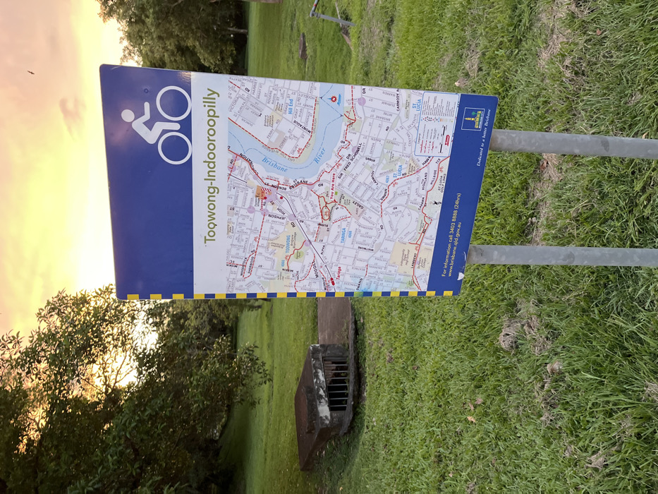
The image displays a blue and white public sign, oriented vertically, providing a map for cyclists in a green, grassy outdoor setting. The sign is supported by two grey metal poles. The background features a dramatic sunset or sunrise sky, painted with vibrant orange and yellow hues, suggesting either early morning or late afternoon with clear weather. The primary subject of the sign is a bicycle route map. A white bicycle symbol is prominent in the upper left corner, next to the text "Toowong-Indooroopilly," indicating the areas covered by the route. The map itself details a section of Brisbane, Australia, showcasing the "Brisbane River" and various suburbs including "St Lucia" and "Taringa," which aligns with the provided location context. Street names like "Coronation Drive," "Sir Fred Schonell Drive," and "Montague Road" are visible, along with an indicator showing "You Are Here" near Taringa. Red lines on the map delineate the cycle paths. Below the map, contact information is provided: "For information call 3403 8888 (24hrs)" and the website "www.brisbane.qld.gov.au." The sign also includes a small logo and the slogan "Dedicated to a better Brisbane," identifying it as a Brisbane City Council initiative. The foreground consists of lush green grass, with a concrete drain grate partially visible in the lower center. Trees and foliage frame the left side of the image, silhouetted against the bright sky. The scene depicts a calm, functional environment intended for guiding cyclists in Taringa, Australia.
No transactions found